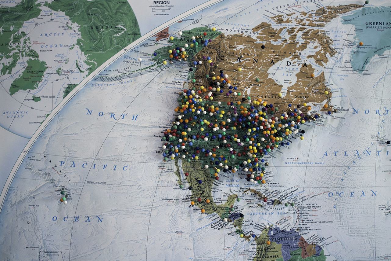
the 500xpedition

chicago to alaska in a fiat 500x

Chicago to Alaska

  • Archive
  • Twitter
  • Blog

THINGS WE LEARNED

September 04, 2017 by Rita Fisher

1. North America is full of surprises. 

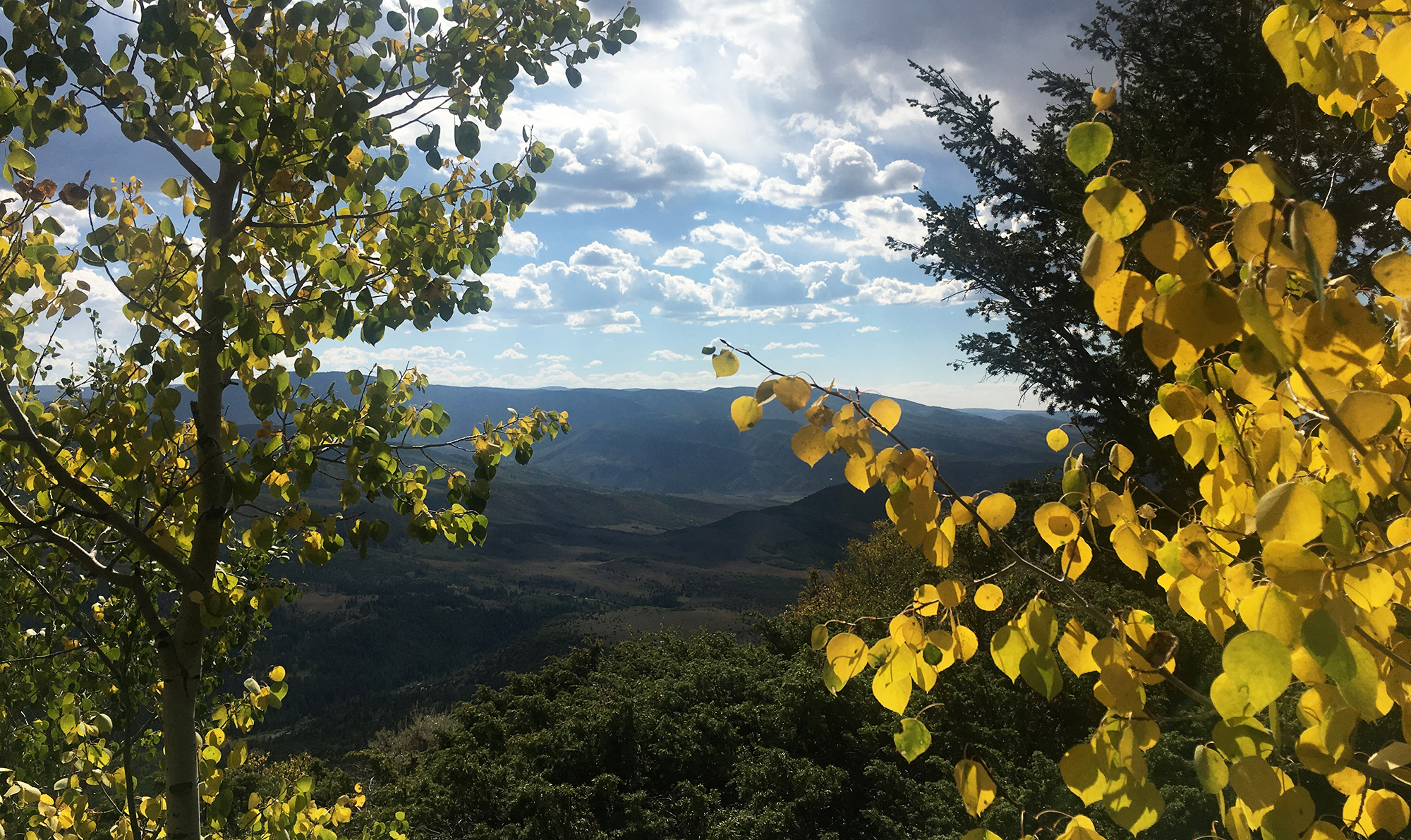
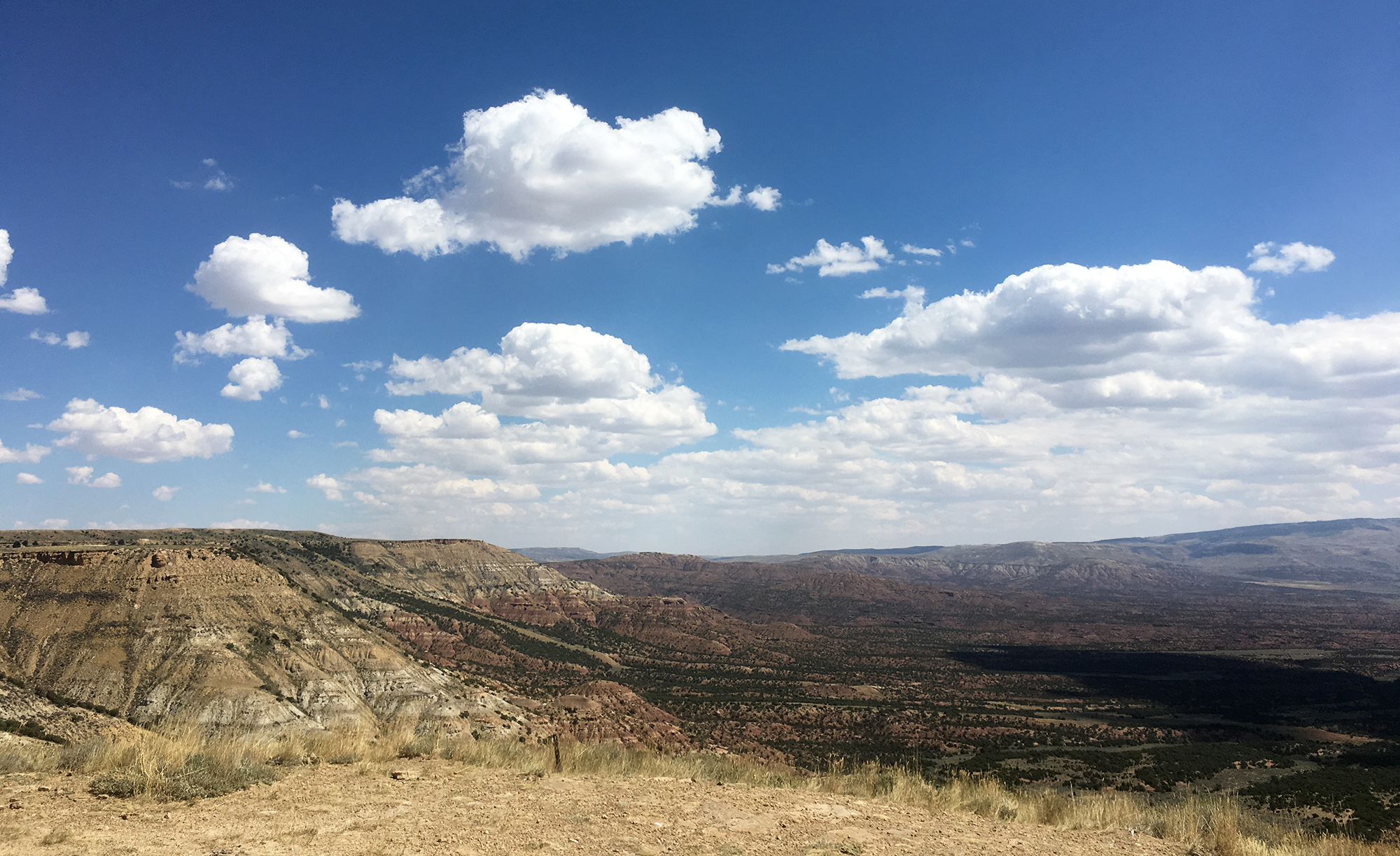
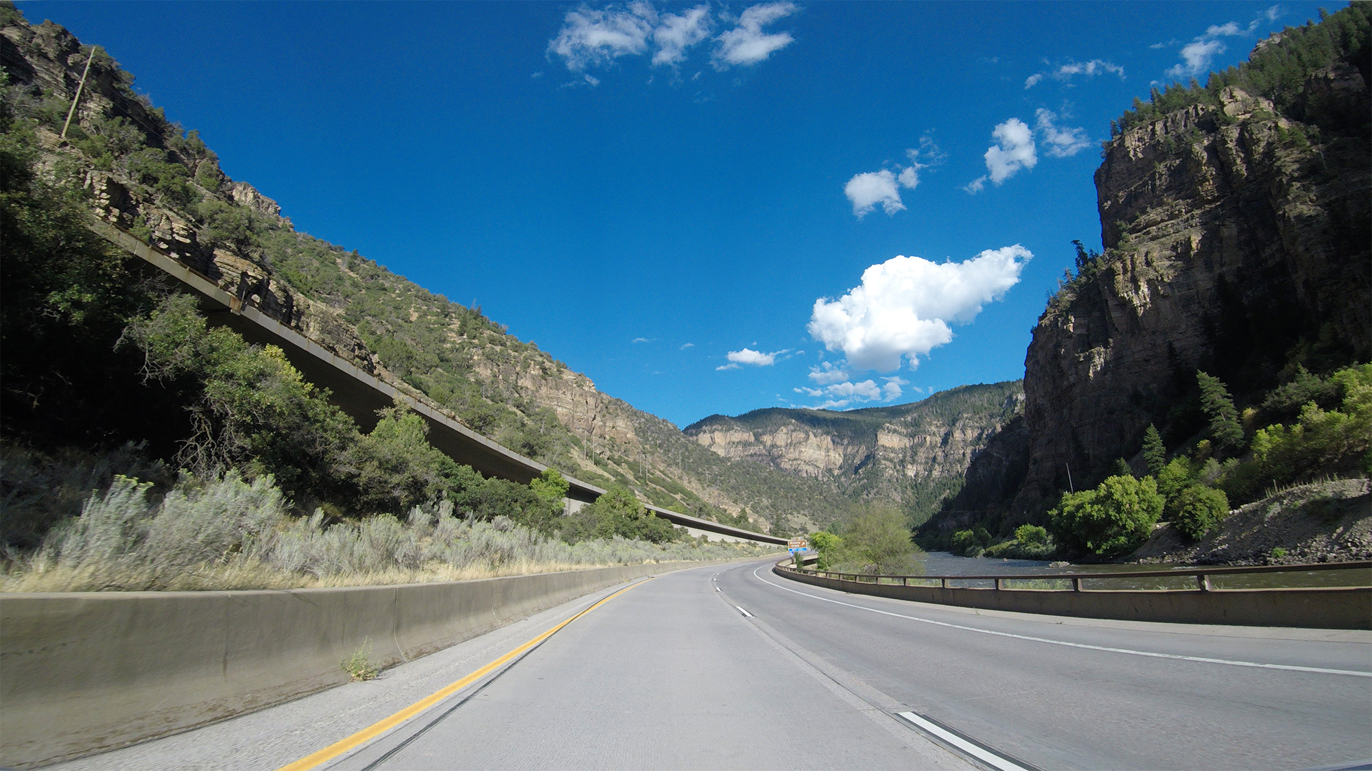
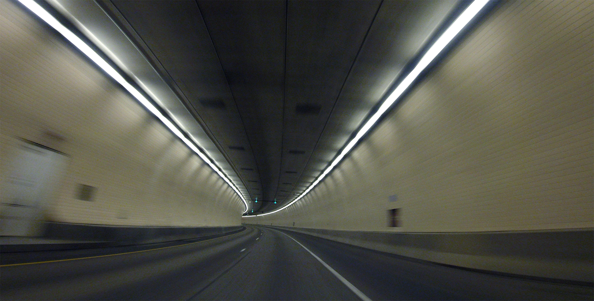
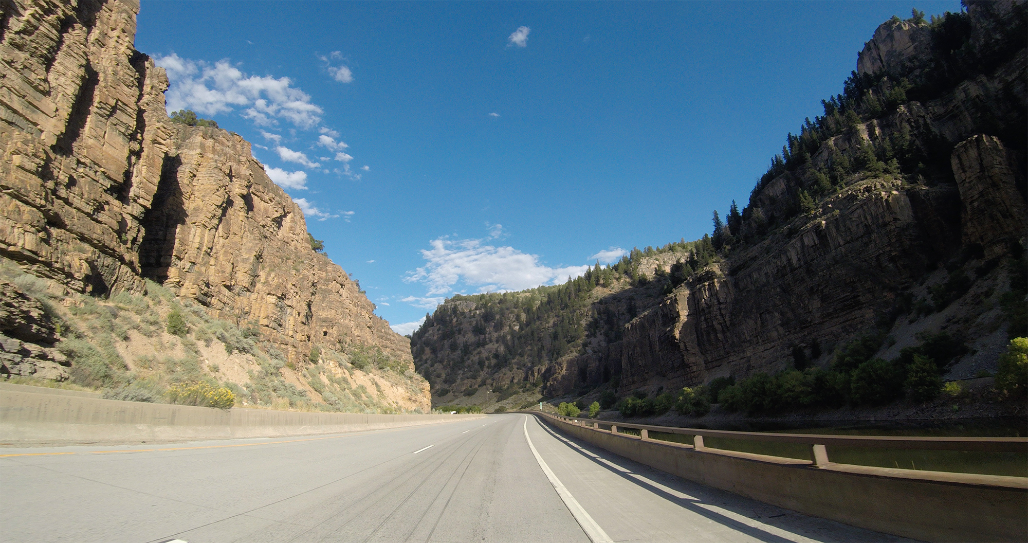
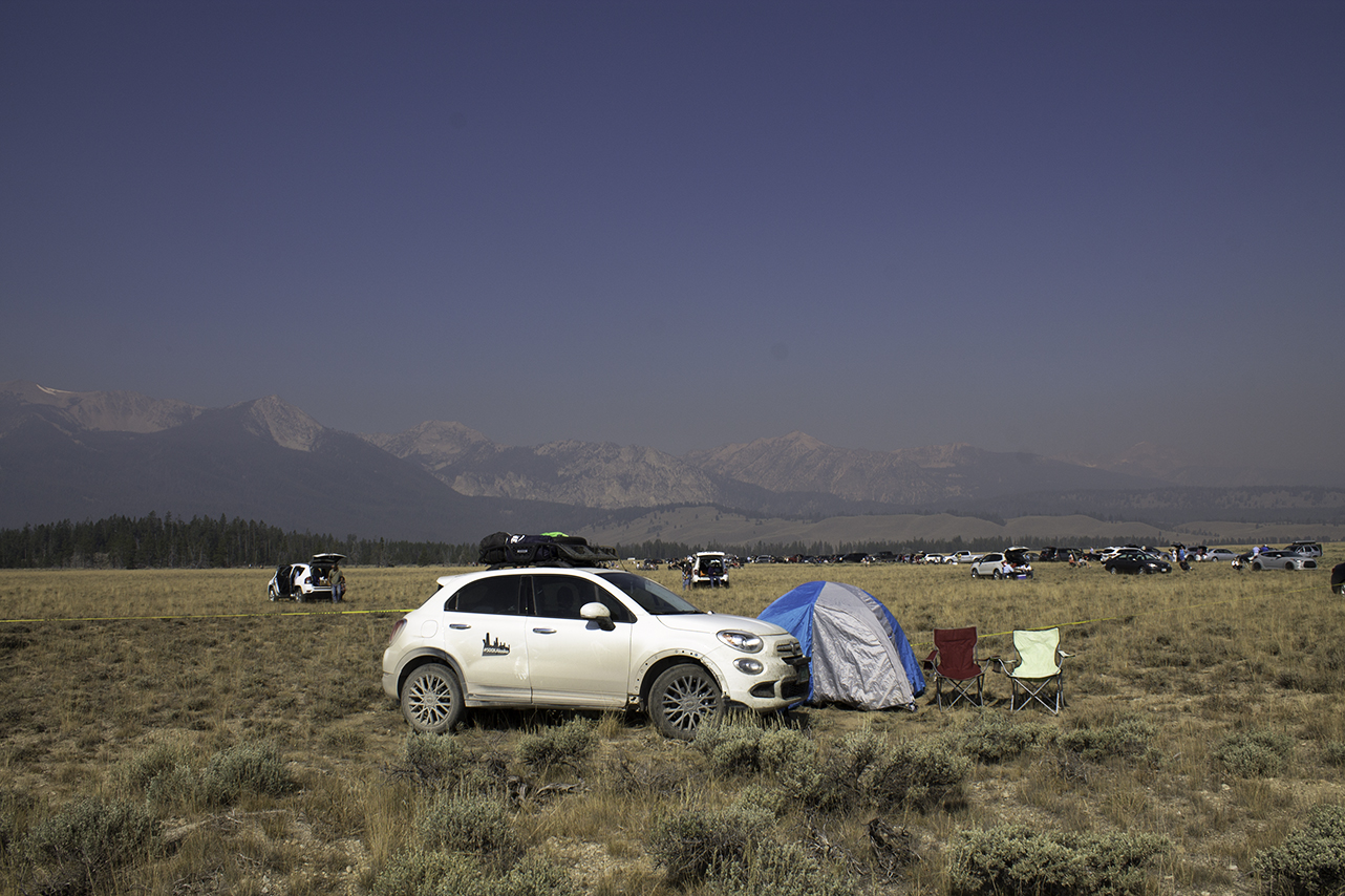
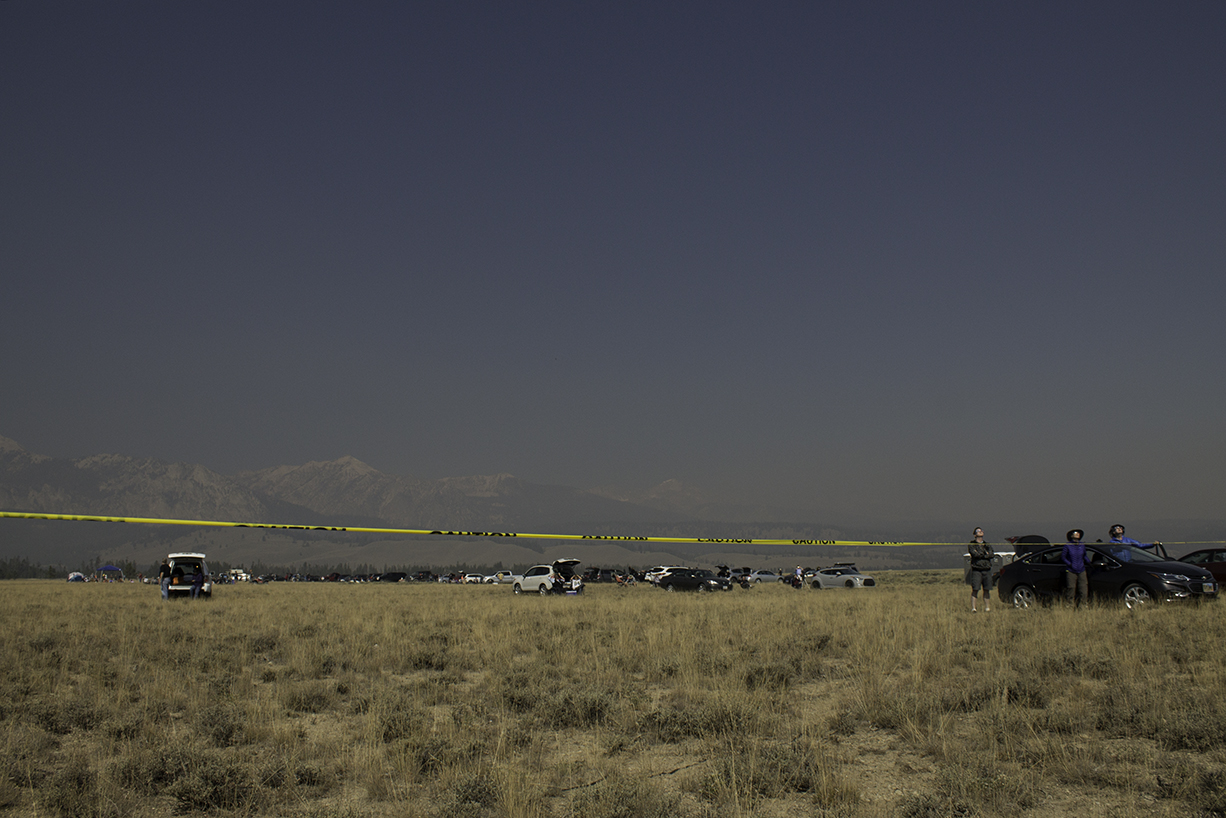
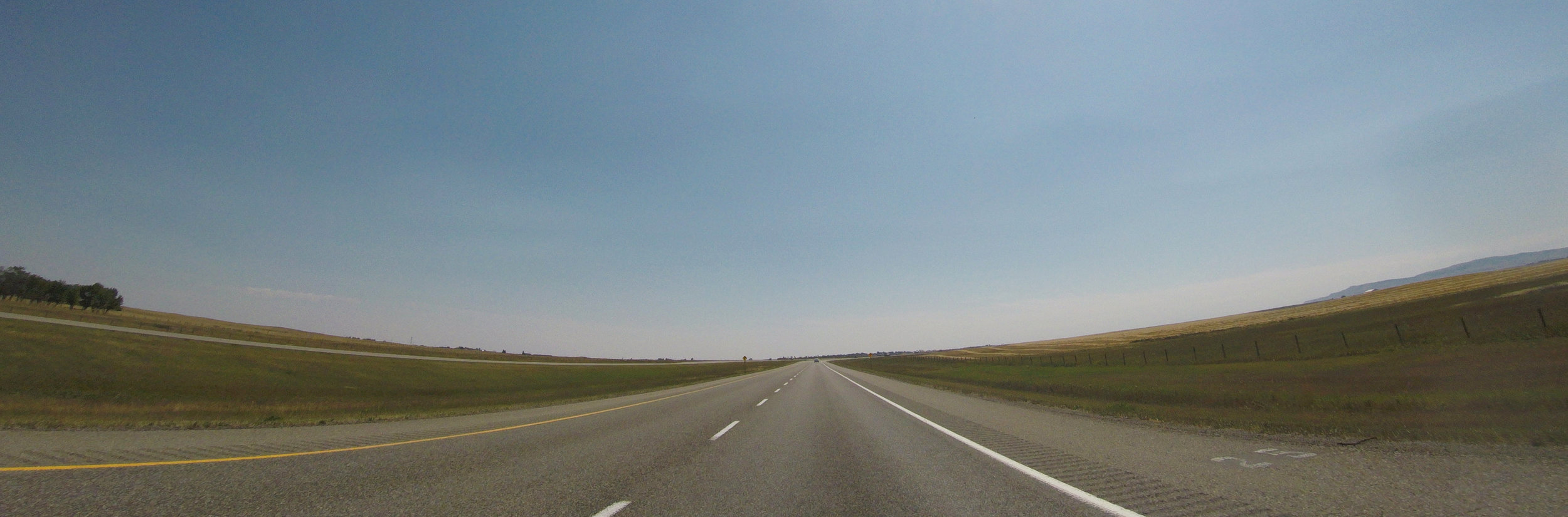
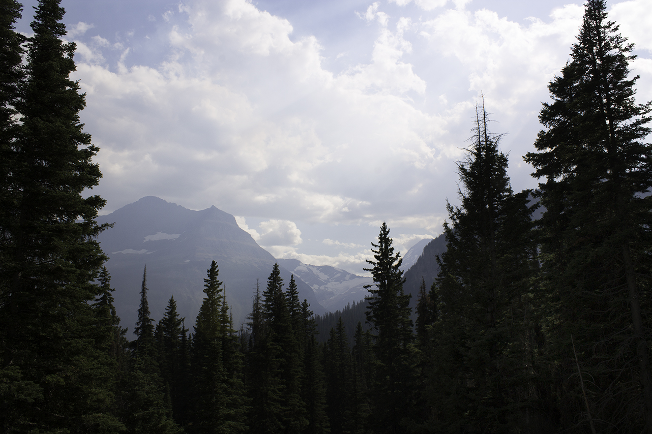
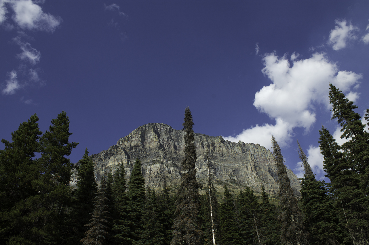
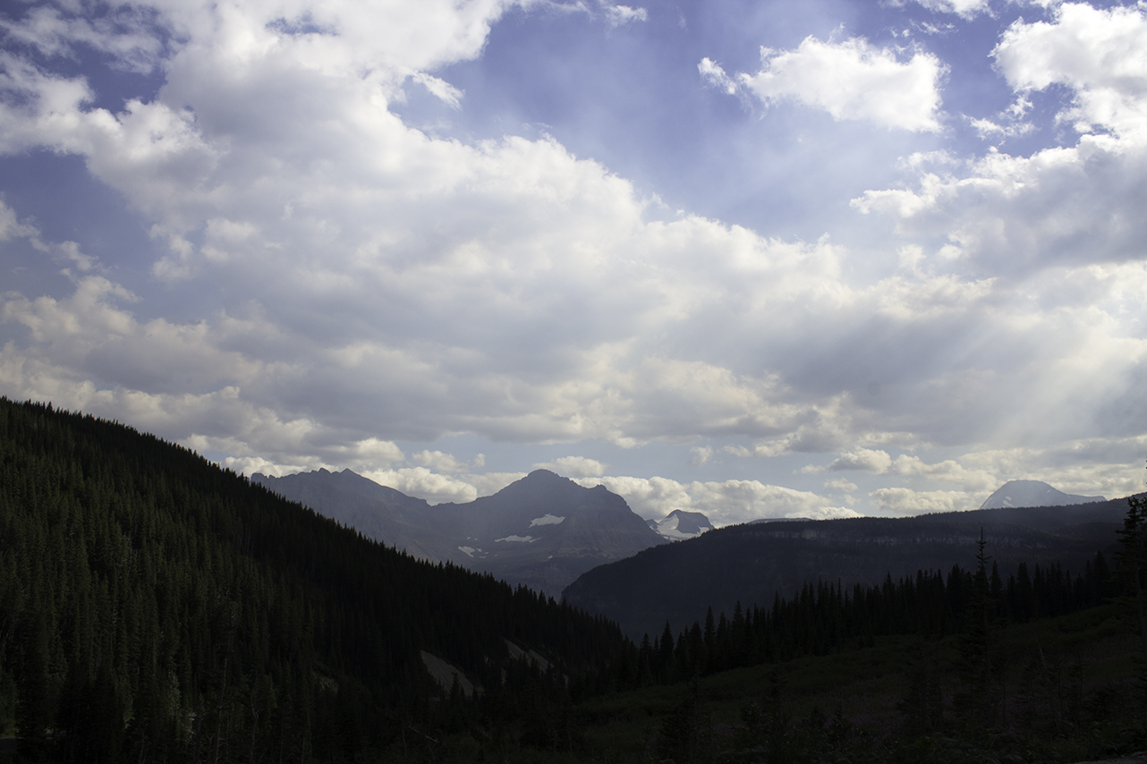
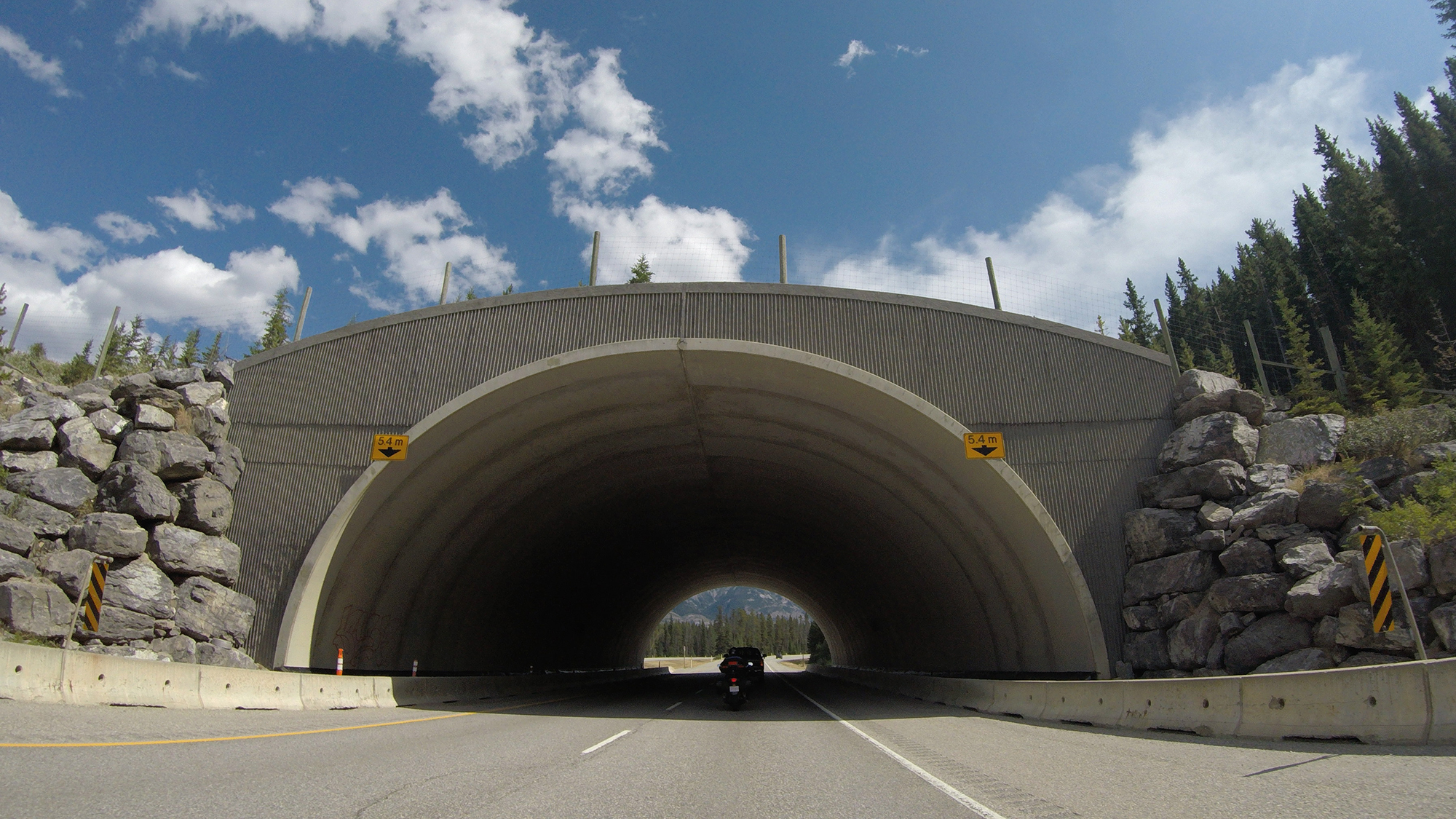
A lot of surprises. And we're really just talking about Mother Nature. Yes, there were a lot of things that we knew were going to be beautiful and amazing, and we made sure all the cameras were charged and that we were in the exact right place at the right time. A perfect example of this would be the total solar eclipse we hustled down to Idaho for (and man, it did not disappoint). There were drives that we knew would be breathtaking: the drive to Prince Rupert, Going-to-the-Sun Road in Glacier, and the drive through Glenwood Canyon on 70, to name a few. 

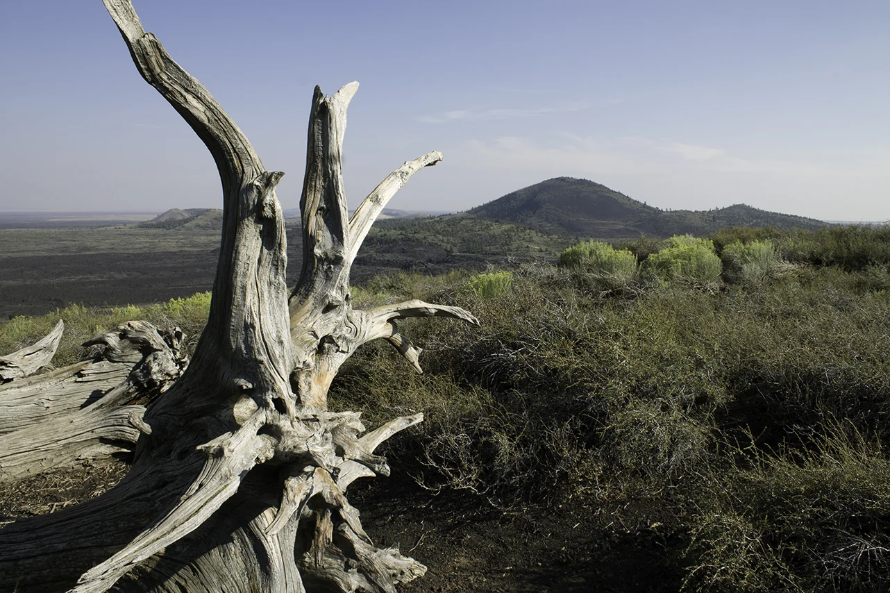
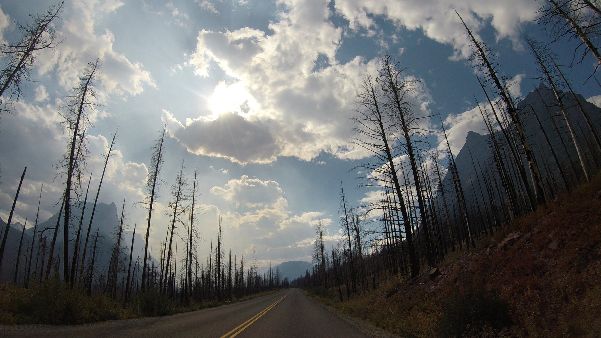
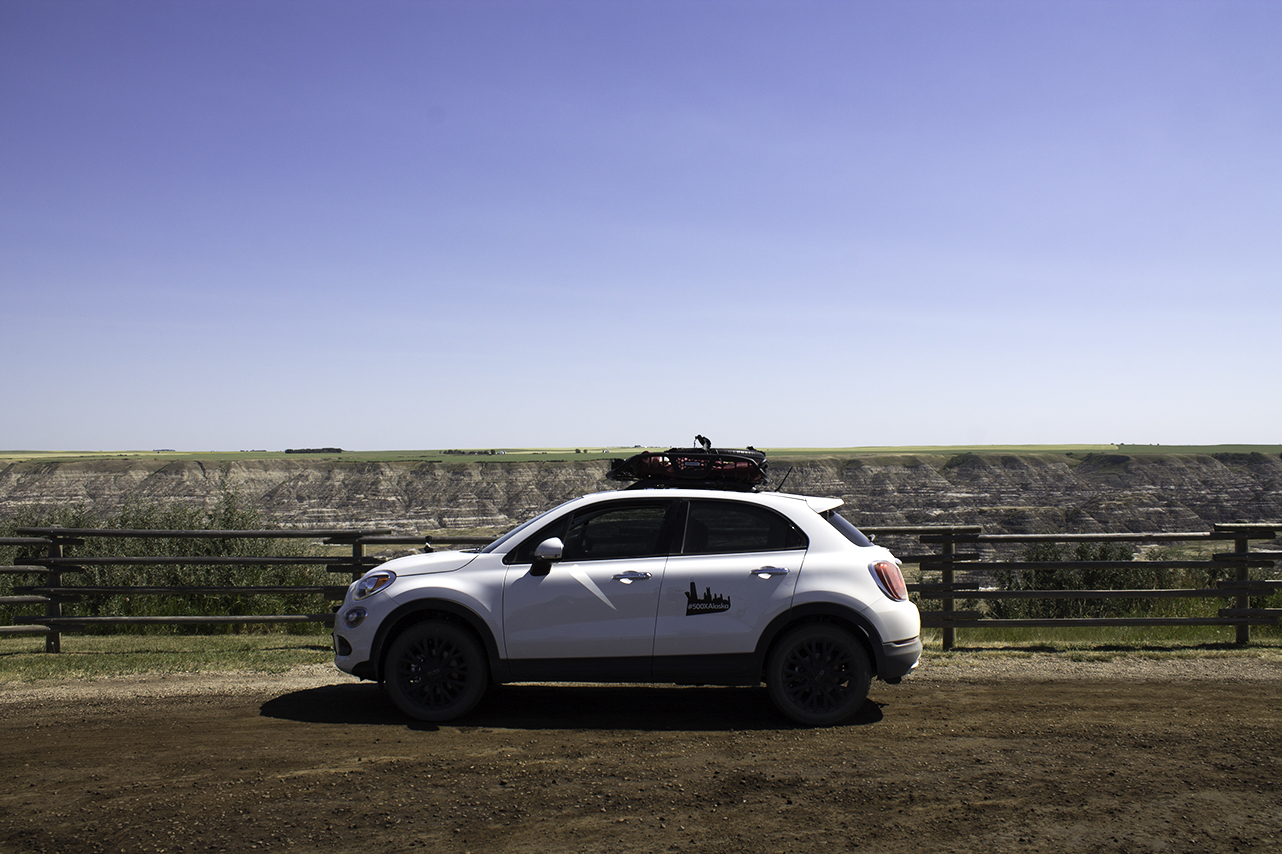
But there were a lot of surprises for which we couldn't plan. Despite an unpromising aurora forecast, we were treated to two spectacular and completely unexpected displays of the Northern Lights in the Yukon Territory. We didn't even know that the Great Sand Hills or Craters of the Moon existed until the day before we arrived at each one (see below). And there's nothing quite like discovering something amazing as you drive through it. The Canadian Badlands in Alberta. Our bizarre and ethereal drive to Circle, Alaska—not to mention the 8 or 9 rainbows we saw on our way back. And, of course, our drive to and through the Sawtooth Valley in Idaho, which left both of us a little dumbstruck. 

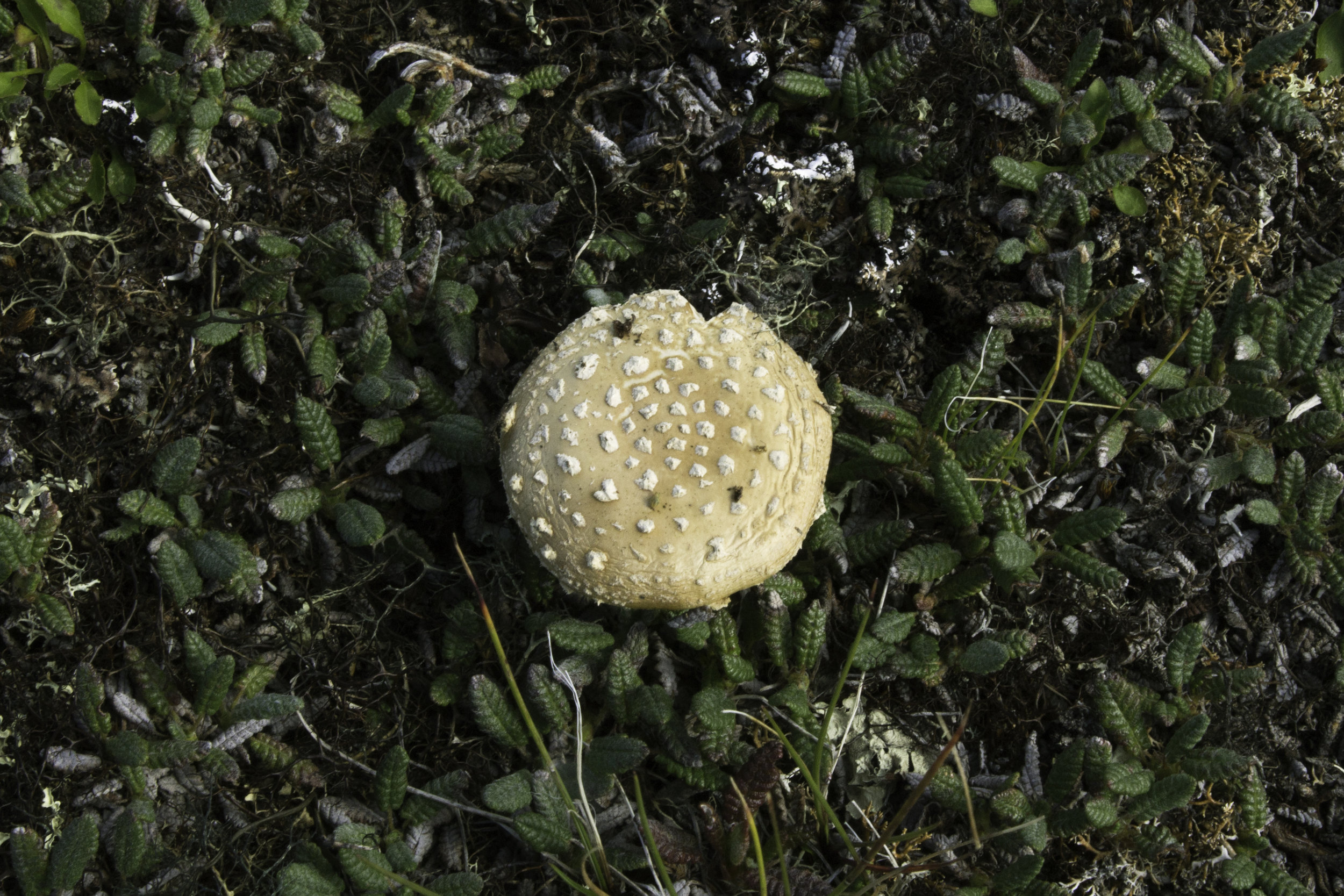
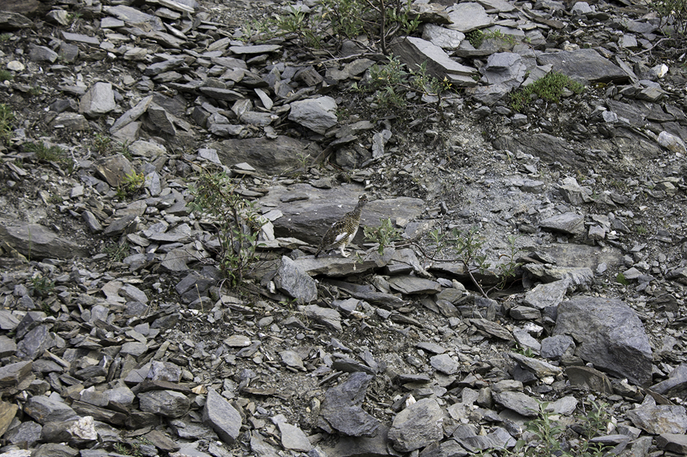
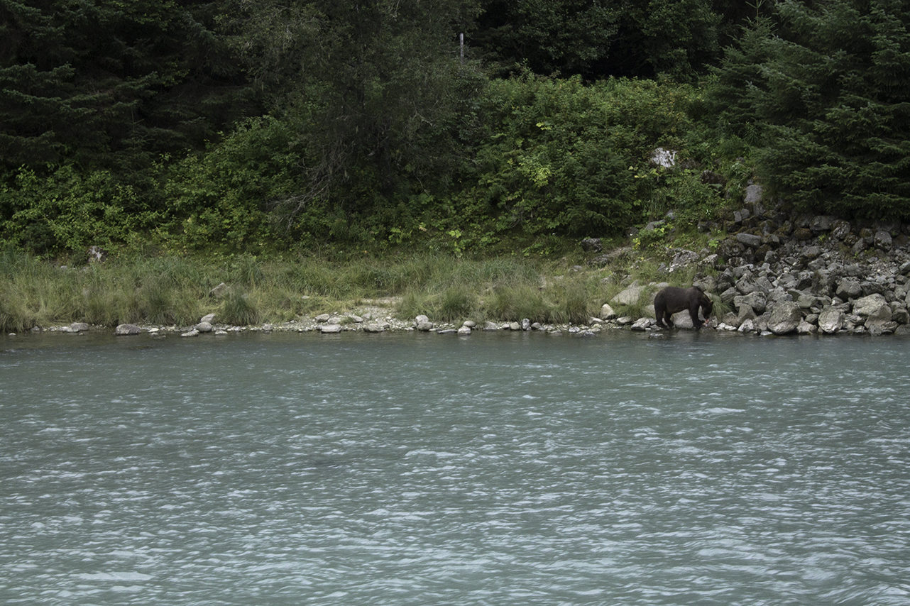
We couldn't have planned for all of the wildlife, like the juvenile brown bear lazily snacking on salmon by the Chilkat River, or the pair of sandhill cranes doing a bizarre sort of hop-dance in a field outside Bellevue, Idaho—something we failed to capture on film, but it looked something like this. There were stone sheep and muskox and herds of deer. And there was the late night visitor to our campsite on the Denali Highway, which leads us to our next lesson...


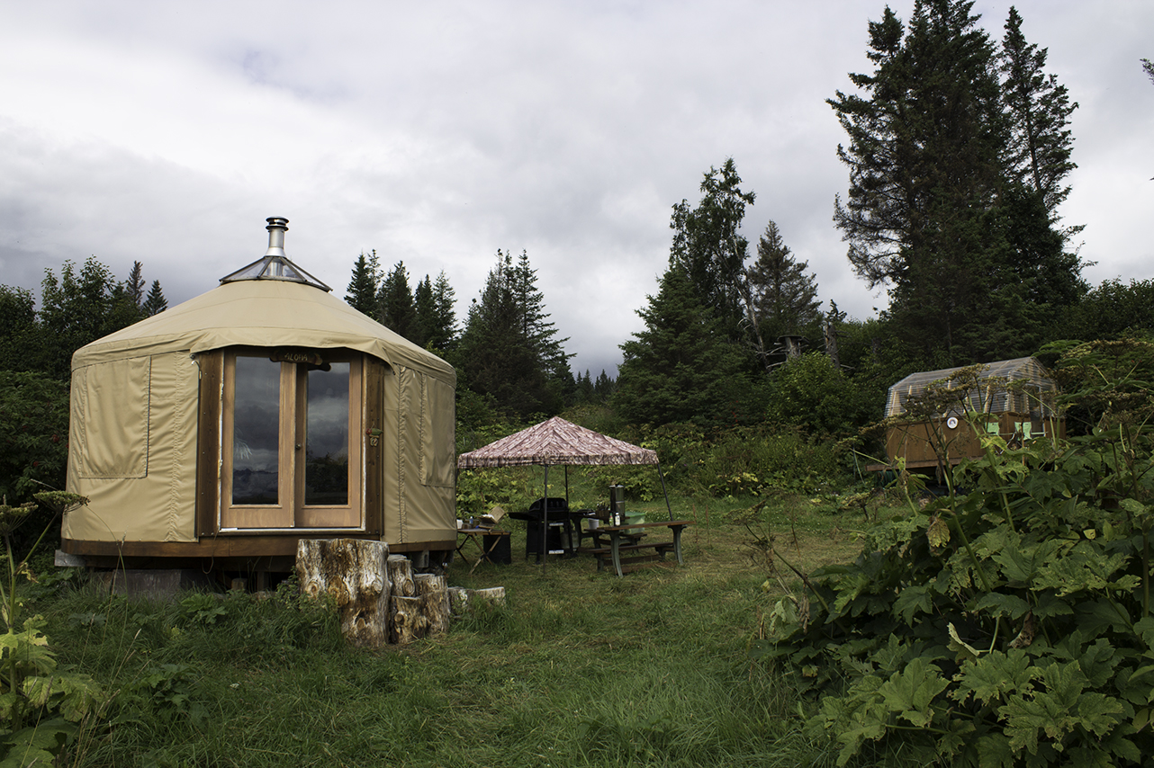
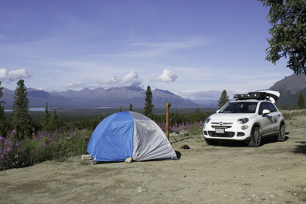
2. Camping is awesome. 

Of course we should have known this. We wish we had camped more, actually. Why isn't everyone camping? We also noticed that it seemed like there was no one under 35 camping with us. Strange, right? That being said, the people that we met (no matter their age) were incredibly interesting—funny and insightful and so happy to sit around a campfire and talk to someone new. And when we were camping somewhere remote and it was just us, that was awesome, too. 

View fullsize 080317_004_CongdonCreekCampground.jpg
View fullsize 080817_001_PackingUpCampsite.jpg
View fullsize 082117_005_Campsite.jpg
View fullsize 080117_006_Matanuska_tent.jpg

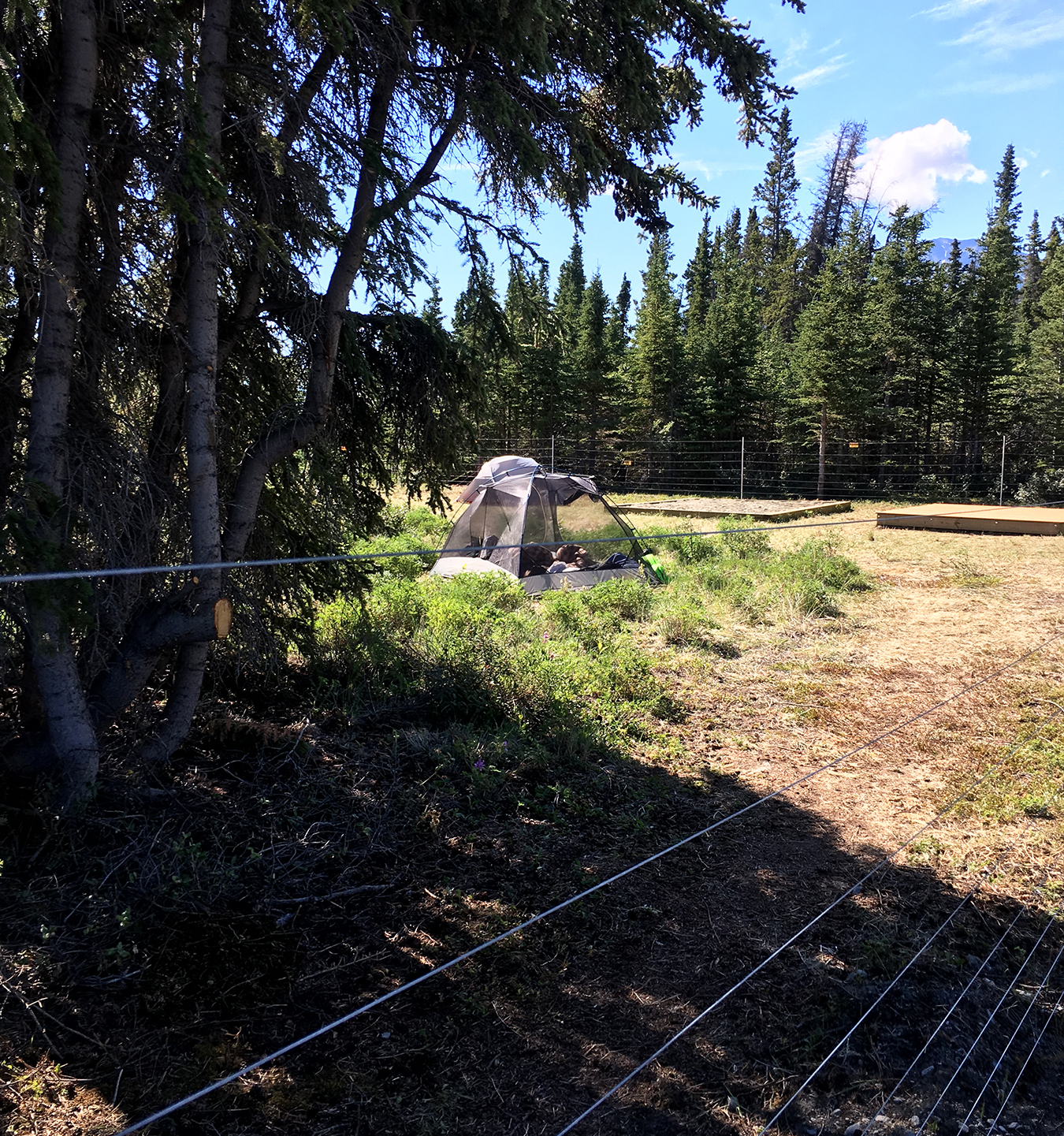
We learned that some of us are better than others at putting up and taking down a campsite, in record time. We learned that if you're camping on the ferry deck on the Alaska Marine Highway System, bring something to hold down your tent/rainfly during windy, rainy nights (duct tape?). We learned that a little dollar store fan can do wonders for cooling down your tent in the morning, and we learned about electric bear fences (and what it feels like to be shocked by one). 


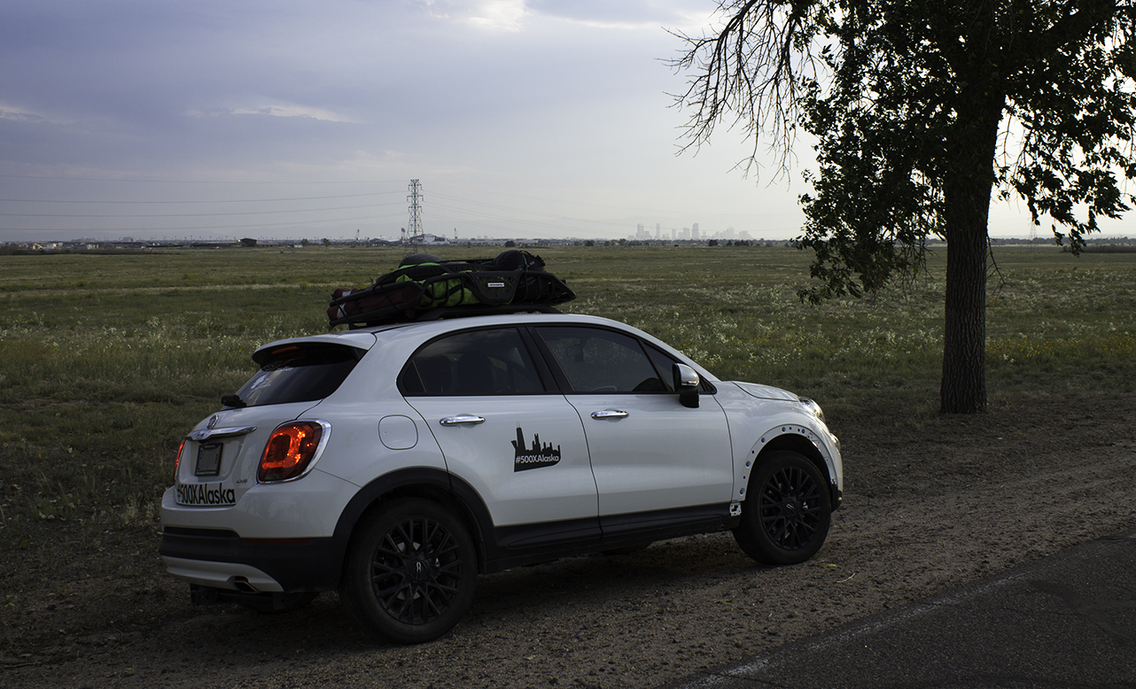
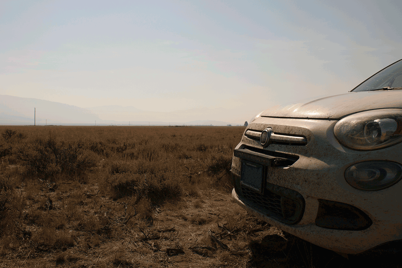
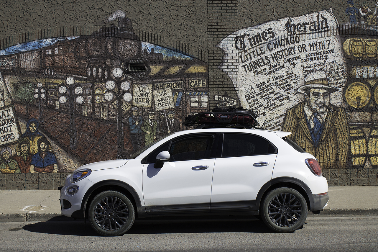
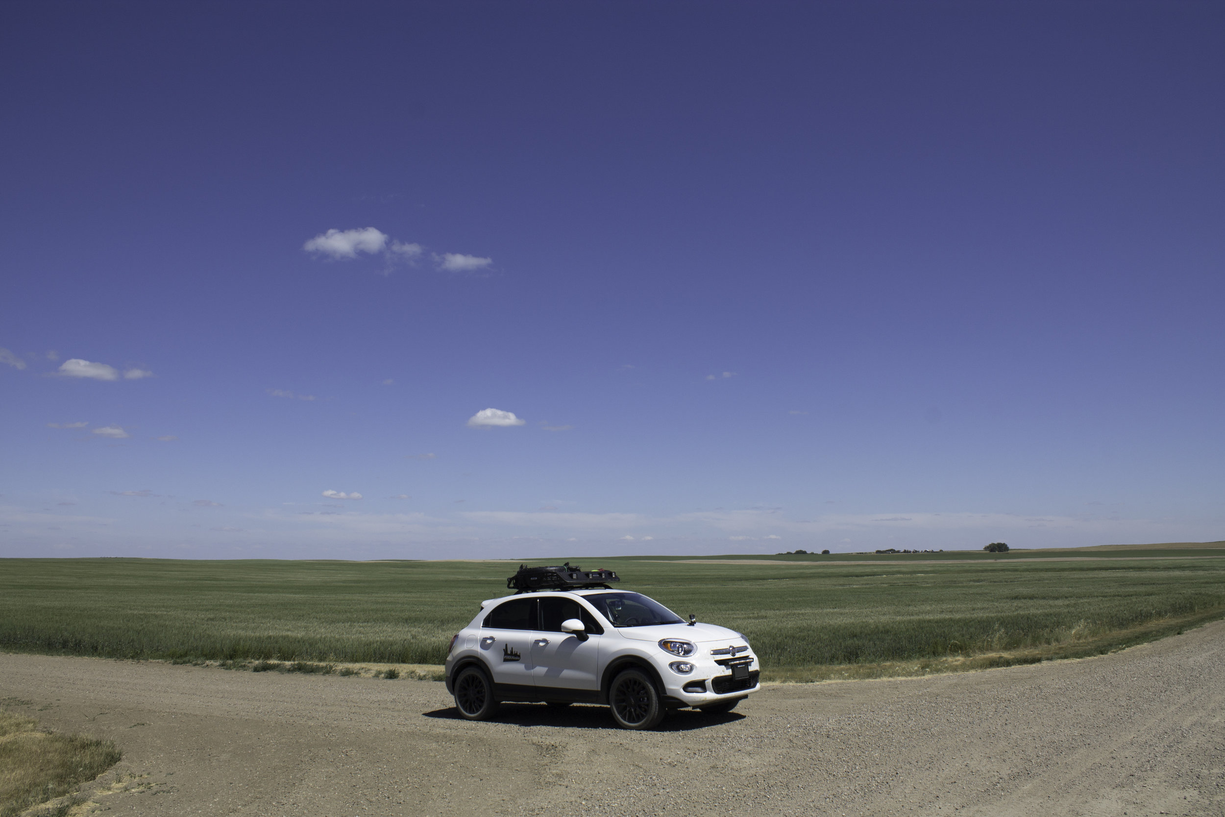
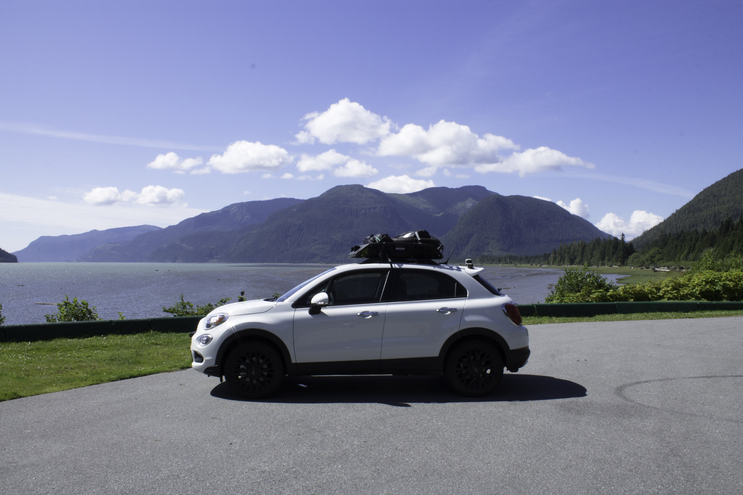
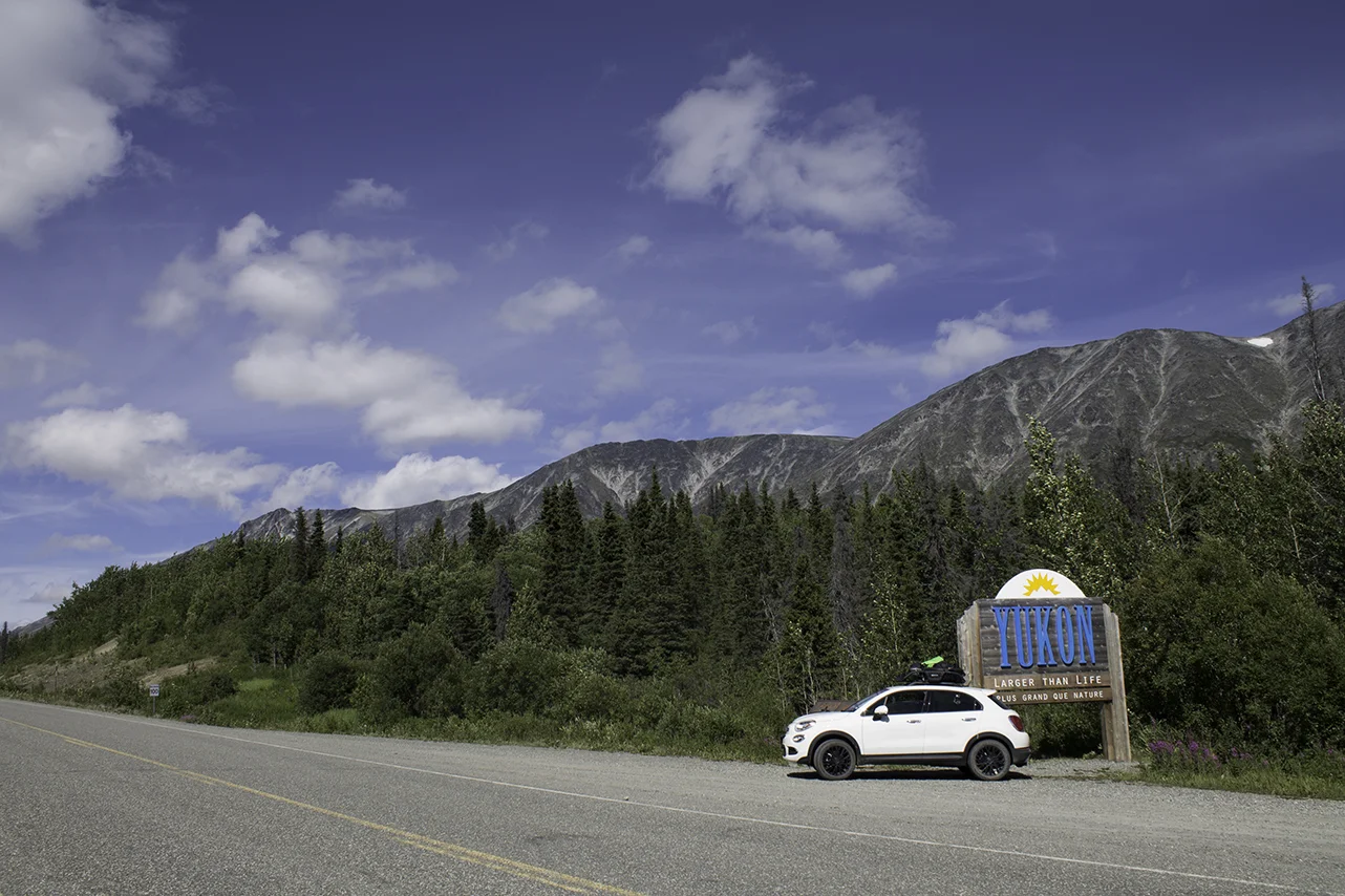
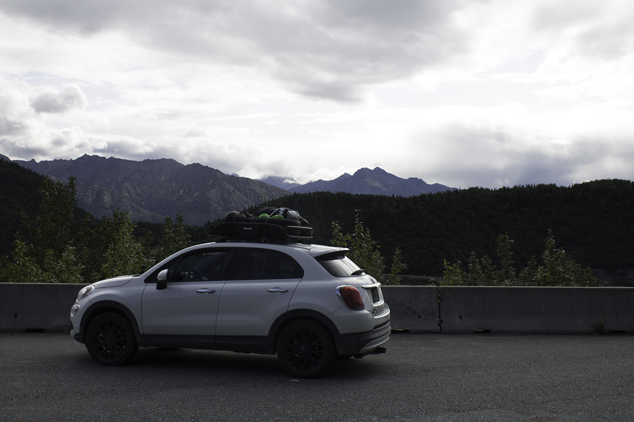
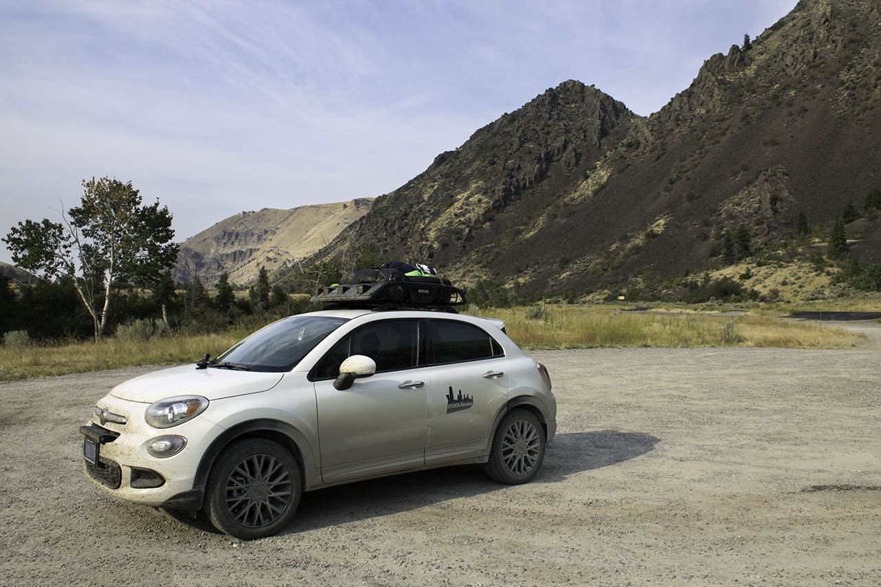
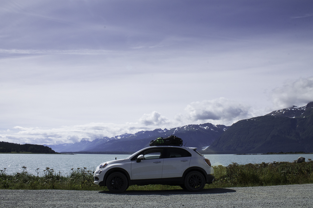
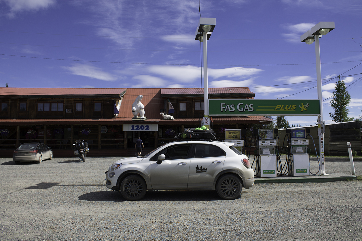
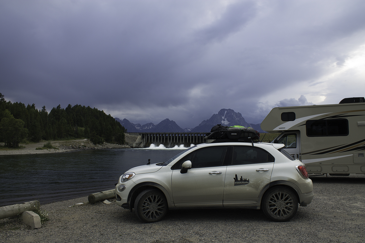
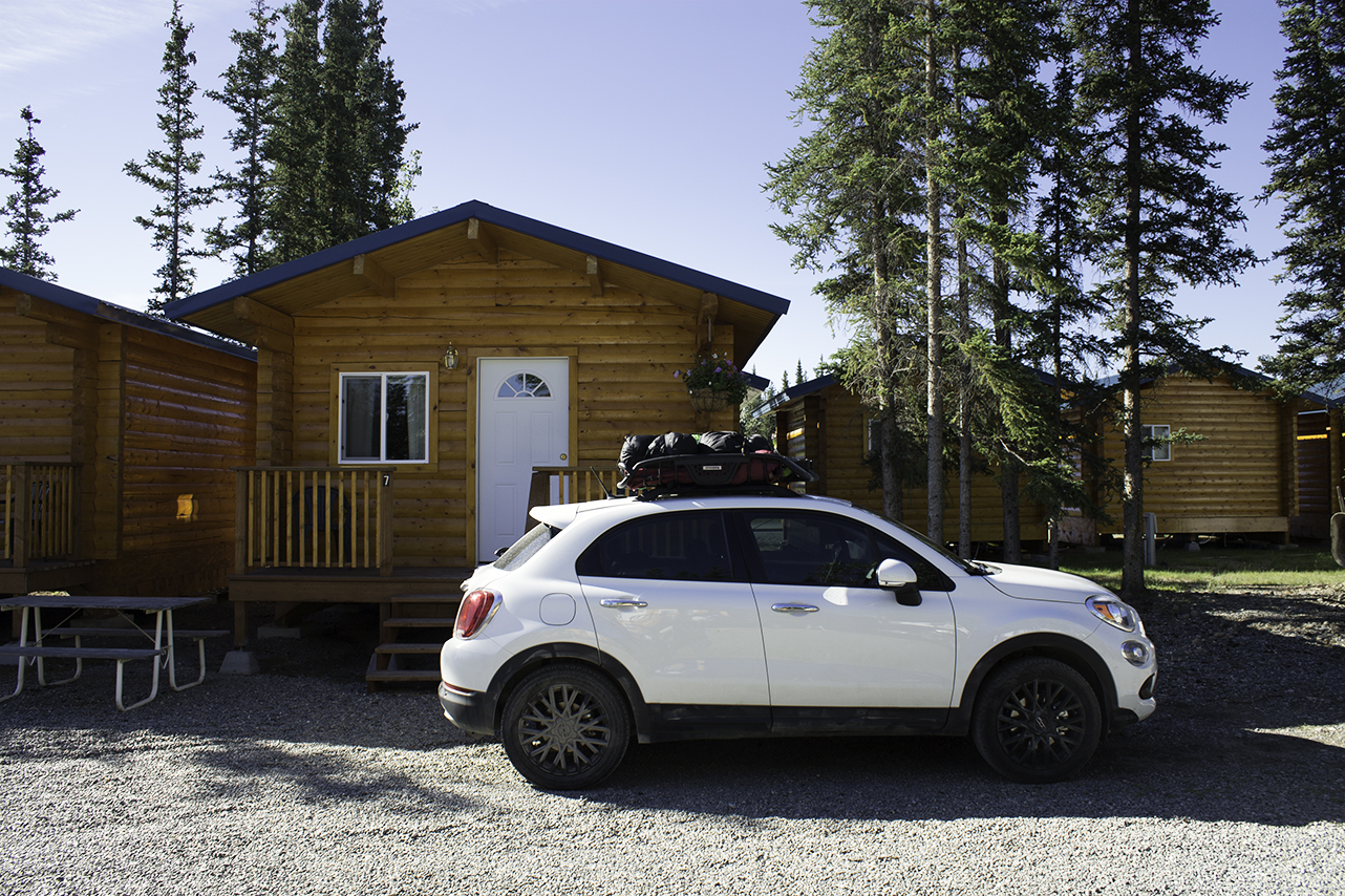
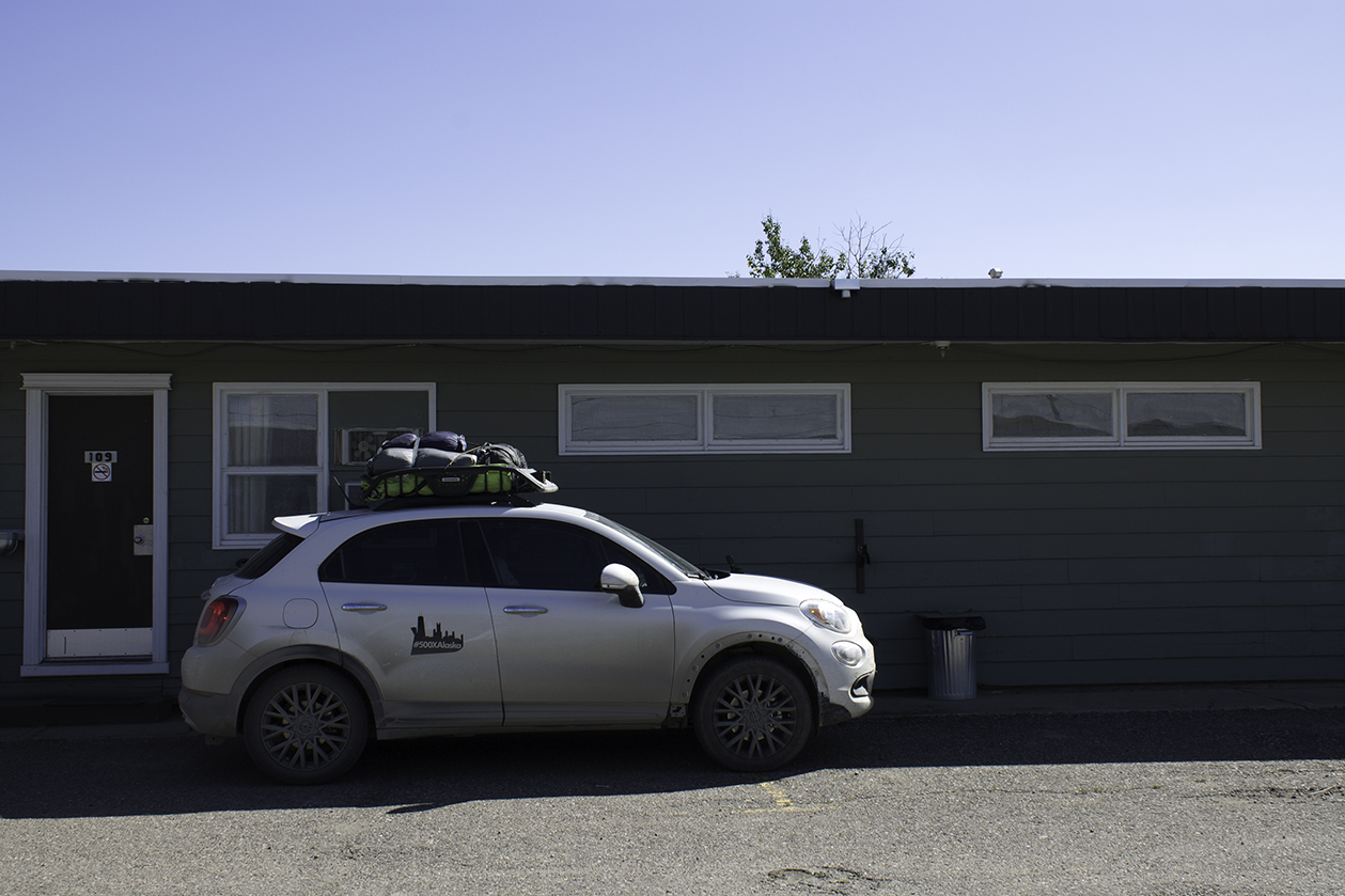
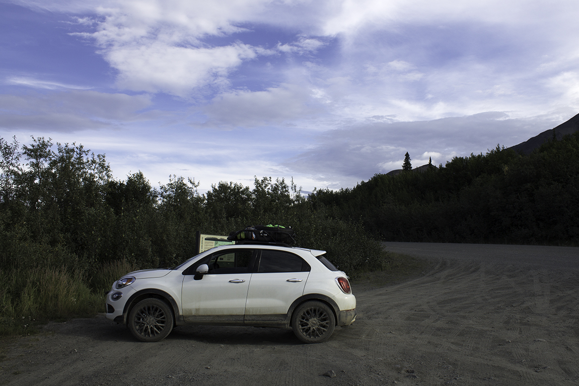
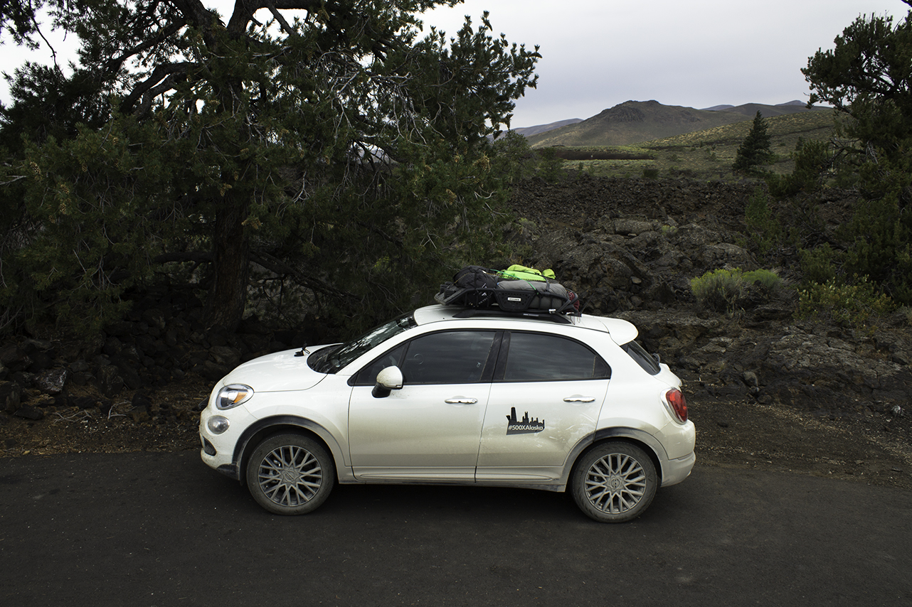
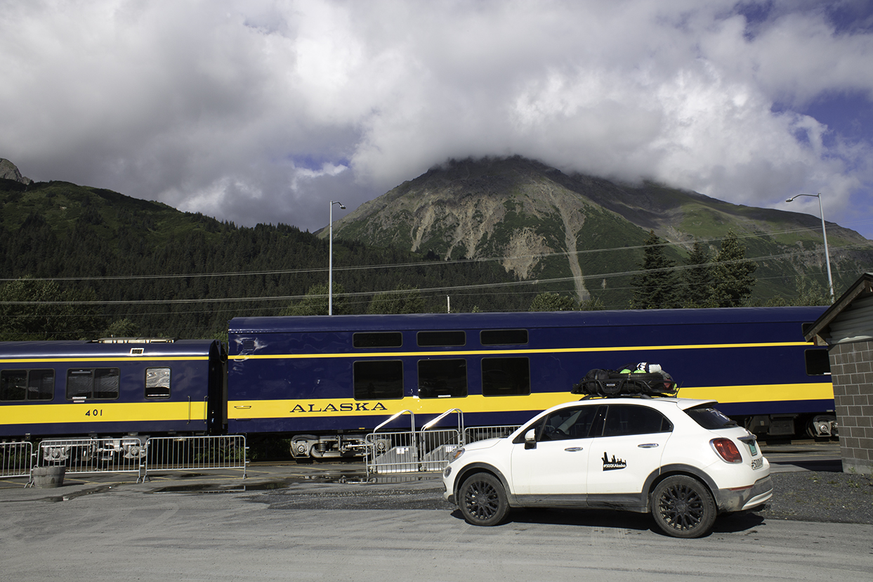
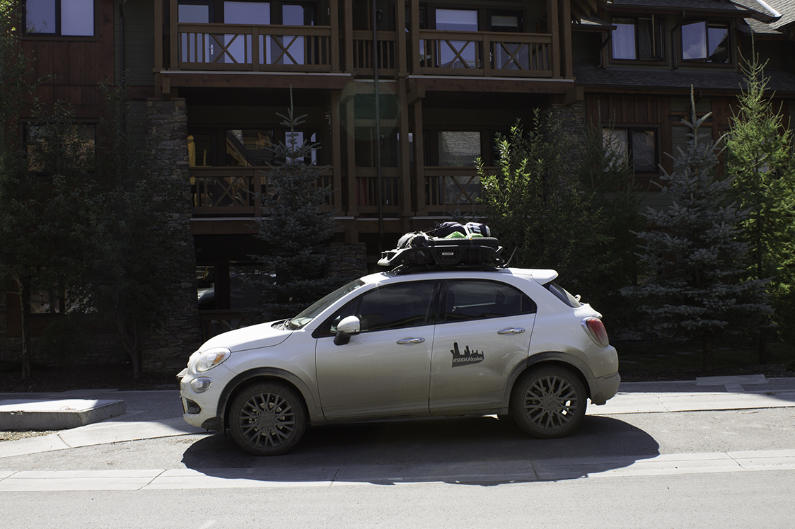
3. WE REALLY LOVED THE 500X.

We're both pretty brand-loyal when it comes to the cars we drive (and neither of us had driven a Fiat before). And yet, from the day we set out in the 500X, we were both smitten. Here's why:

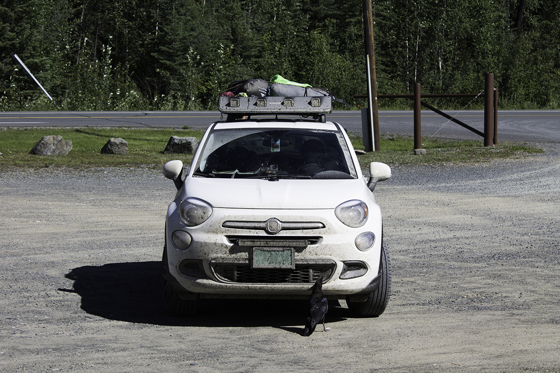
We took the car down some of the roughest dirt roads we've ever seen. We drove over miles of deep frost heaves, along steep cliff-side roads and into deep, brush-filled valleys on gravel roads that maybe weren't roads after all. The 500X just kept on trucking. And the car looked damn good doing it, even plastered with a colony of dead insects and coated in an inch of sand and dirt. 

500xinLittleChicago.jpg
500x_at_PineBungalows.jpg
500x_GreatSandHills.jpg
073117_DrivetoPrinceRupert_007_500X.jpg
080317_006_DrivingintheYukon.jpg
500x_DinosaurProvincialPark.jpg
081417_011_500X.jpg
082017_001_500XinIdaho.jpg
082417_005_FremontLake500X.jpg
082517_005_RockSprings500X.jpg
080217_005_CaratCaptainsChoice_cropped.jpg
080317_003_Car_ChilkatLake.jpg
080417_004_Car_FasGas.jpg
82317_001_CarByDam.jpg
20160601_CaratOrkneyLookout.jpg
080317_008_TokRVVillage.jpg
081617_006_ShannonMotel.jpg
080317_006_CrowEatingBugs.jpg
080617_007_DrivingtoCircle.jpg
080717_006_DenaliHighway.jpg
080817_001_PackingUpCampsite.jpg
080817_007_ValdezCamping.jpg
080817_008_DrivingtoValdez.jpg
082317_016_Campsite.jpg
081117_Homestead_004.jpg
081417_001_Seward.jpg
081817_003_Canmore.jpg
083017_018_RockyMountainArsenal.jpg
500xinLittleChicago.jpg 500x_at_PineBungalows.jpg 500x_GreatSandHills.jpg 073117_DrivetoPrinceRupert_007_500X.jpg 080317_006_DrivingintheYukon.jpg 500x_DinosaurProvincialPark.jpg 081417_011_500X.jpg 082017_001_500XinIdaho.jpg 082417_005_FremontLake500X.jpg 082517_005_RockSprings500X.jpg 080217_005_CaratCaptainsChoice_cropped.jpg 080317_003_Car_ChilkatLake.jpg 080417_004_Car_FasGas.jpg 82317_001_CarByDam.jpg 20160601_CaratOrkneyLookout.jpg 080317_008_TokRVVillage.jpg 081617_006_ShannonMotel.jpg 080317_006_CrowEatingBugs.jpg 080617_007_DrivingtoCircle.jpg 080717_006_DenaliHighway.jpg 080817_001_PackingUpCampsite.jpg 080817_007_ValdezCamping.jpg 080817_008_DrivingtoValdez.jpg 082317_016_Campsite.jpg 081117_Homestead_004.jpg 081417_001_Seward.jpg 081817_003_Canmore.jpg 083017_018_RockyMountainArsenal.jpg

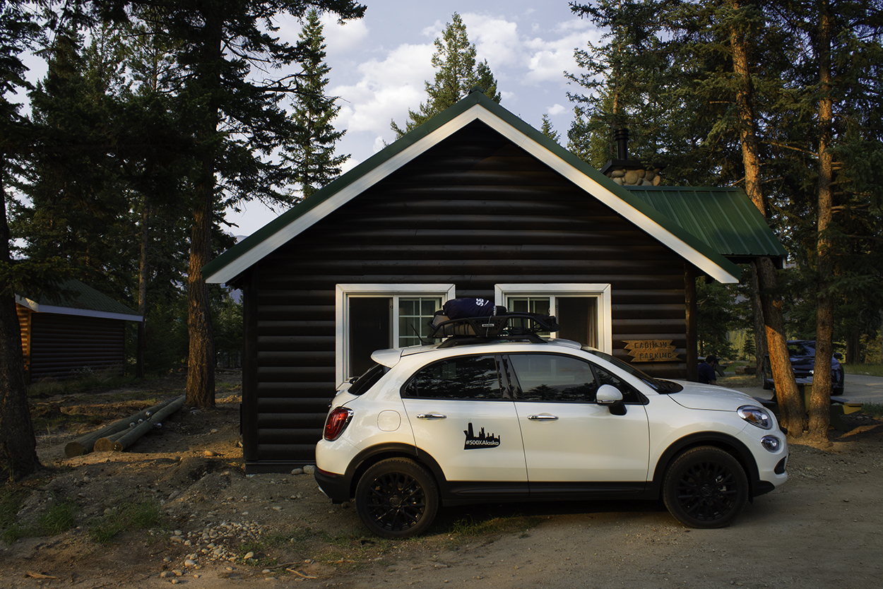
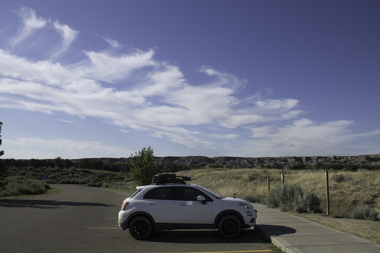
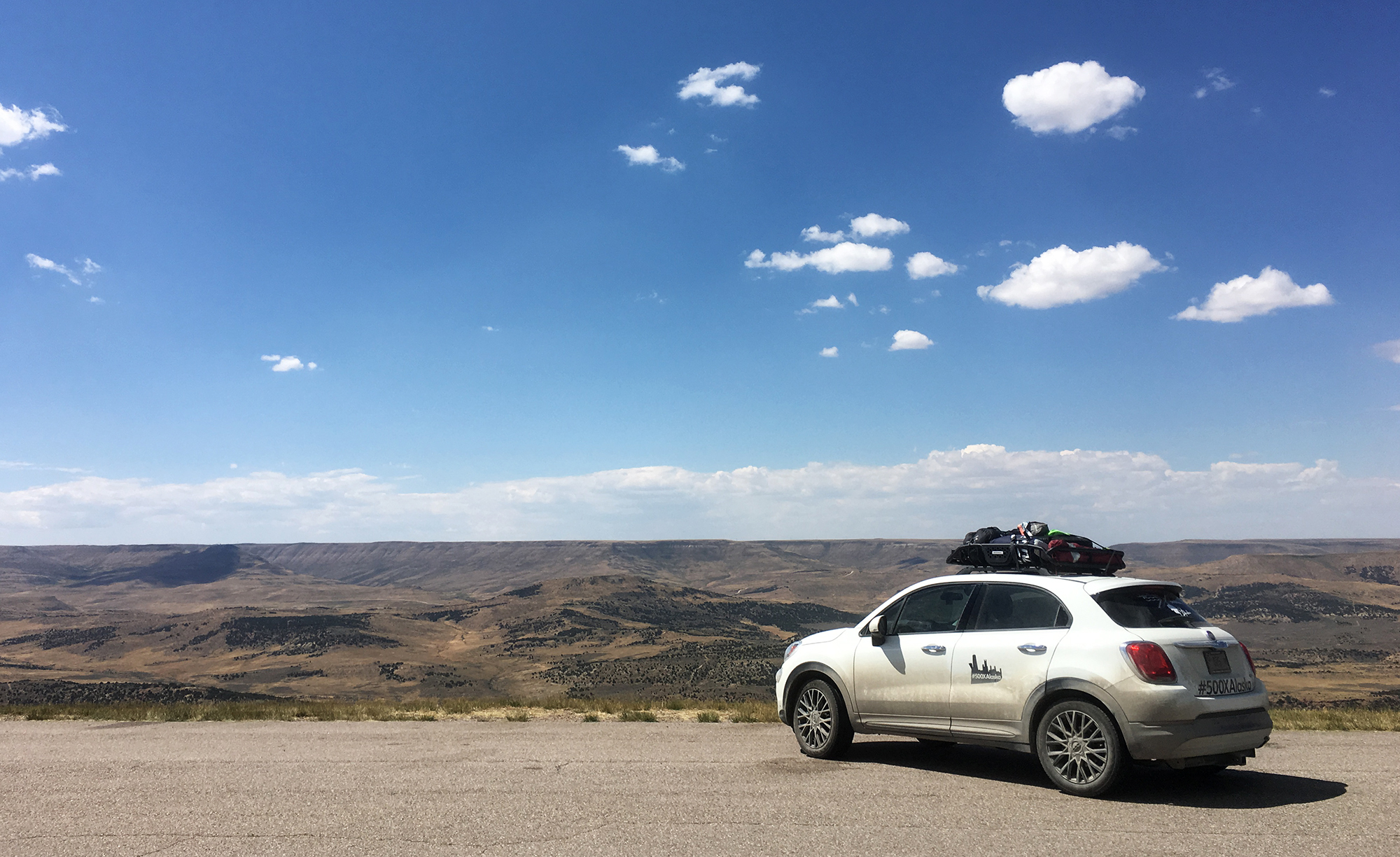
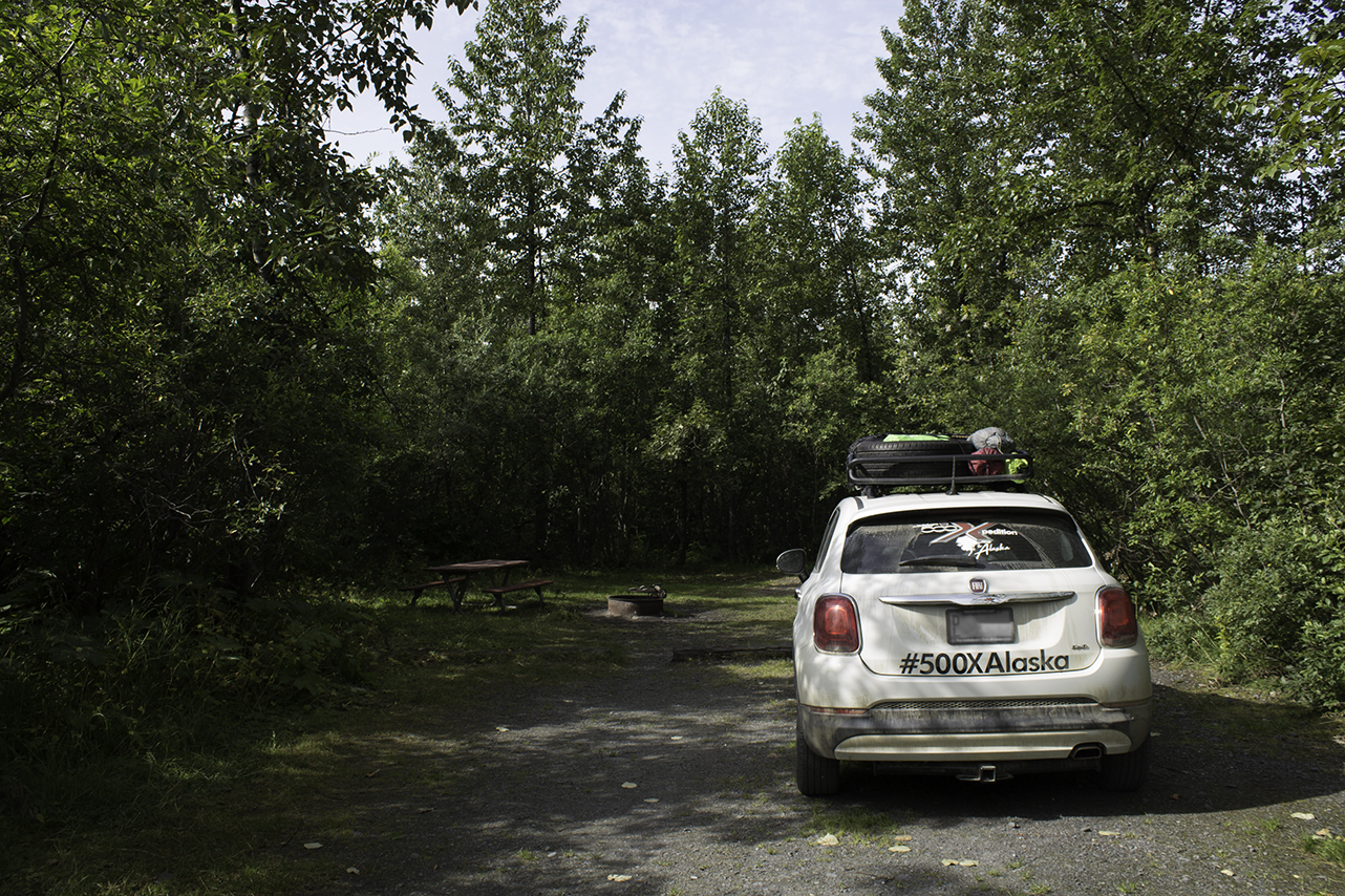
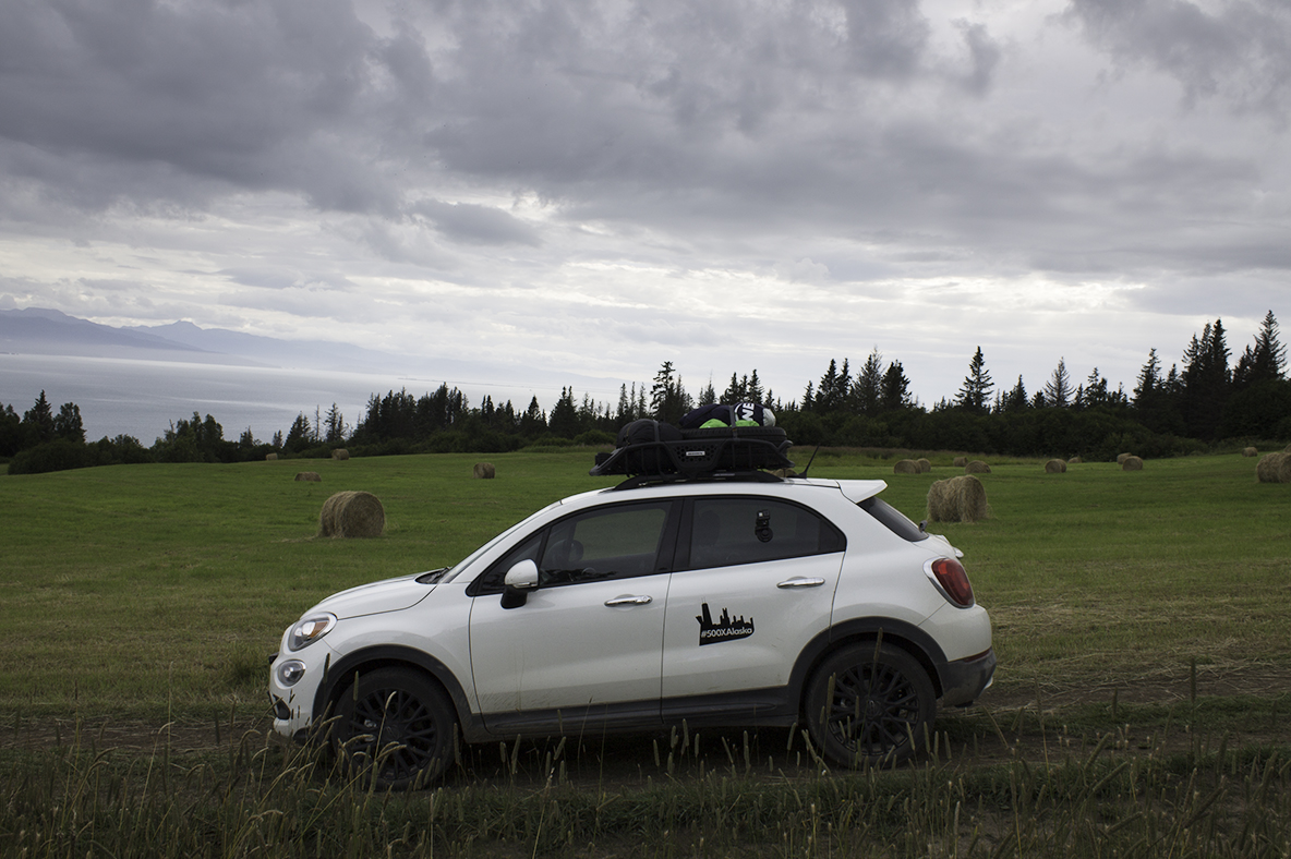
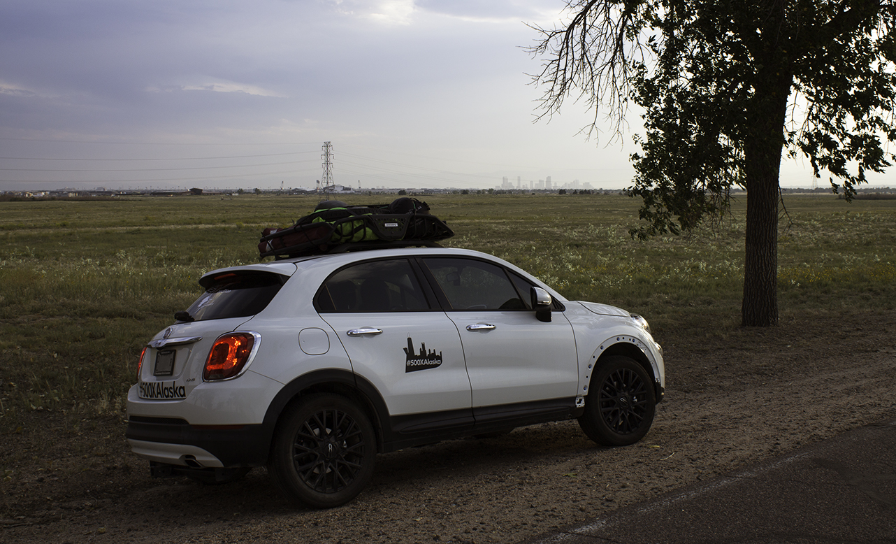
The amount that we were able to fit in the car was downright impressive. All of our camping gear, two coolers, enough clothes to get us through at least a few weeks, plus hiking gear and guide books and souvenirs and a small air mattress and two pillows and a solid amount of snacks and both of us. We even slept in the car one night, which required a lot of moving around of all that stuff... but it worked! 

The car had everything we never knew we always needed. The satellite radio got us through hours of driving with no local radio, no visual stimuli, and no cell service. All of the interior compartments and cubbies kept us organized, holding onto our GoPros and road maps and sunglasses and chargers and everything else we could possibly need. And we were comfortable for hours on end, which is no small feat. 

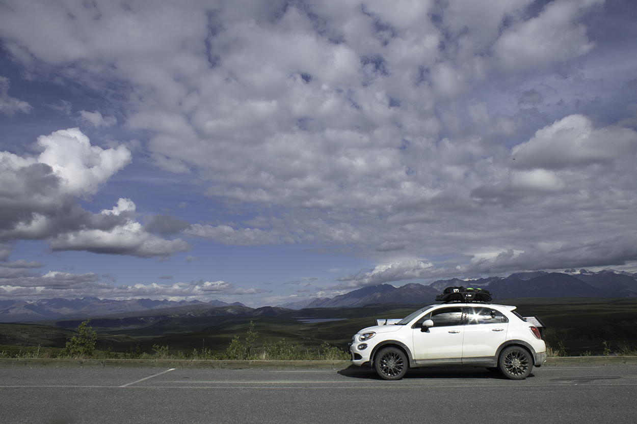
"You drove all the way from Chicago in that?" We heard that over and over as we pulled in somewhere and met the locals, our fellow campers, or our hosts for the evening. That tone of surprise and respect was music to our ears. We really enjoyed how much the 500X defied expectations, parked alongside giant trucks and RVs the size of small mountains. 


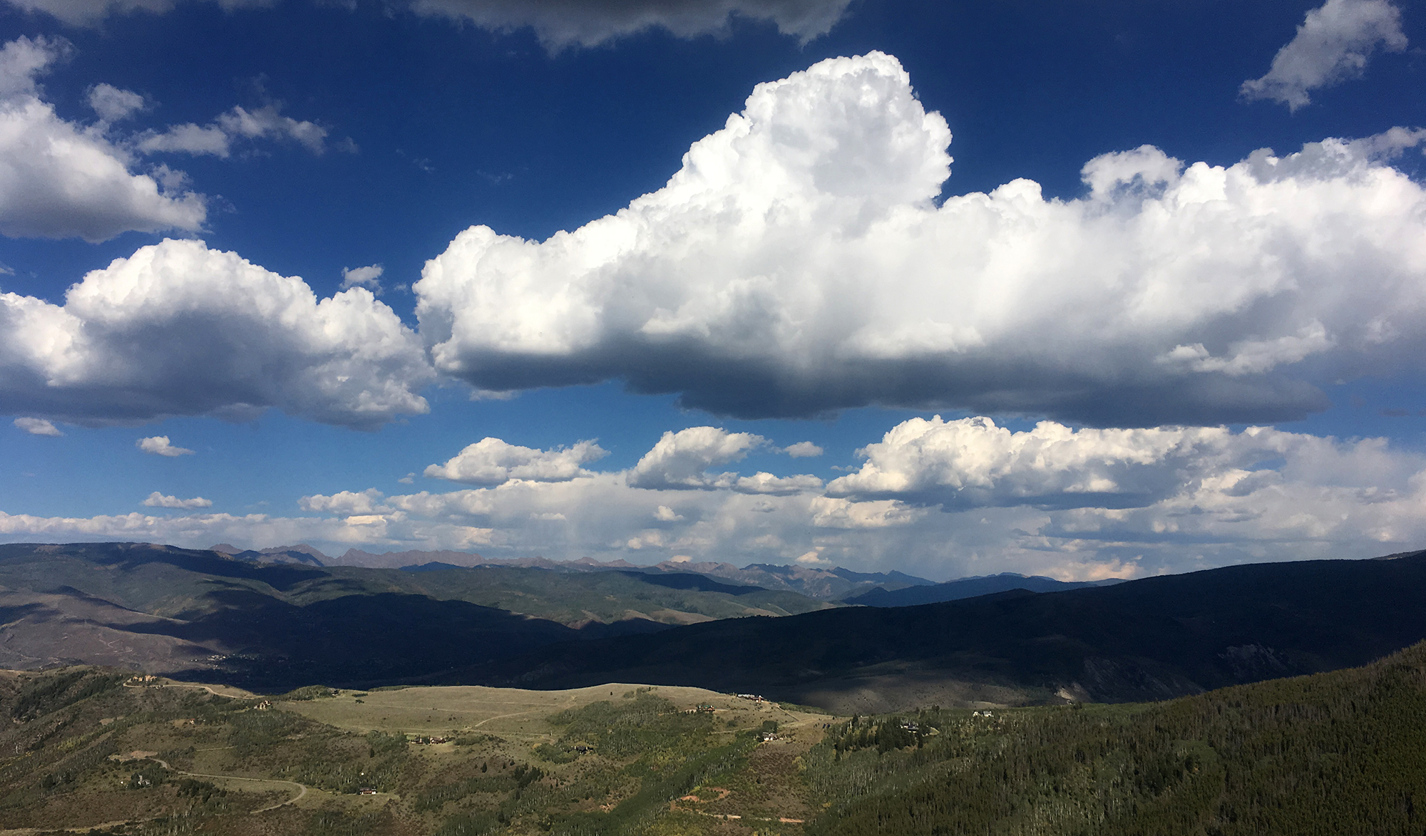
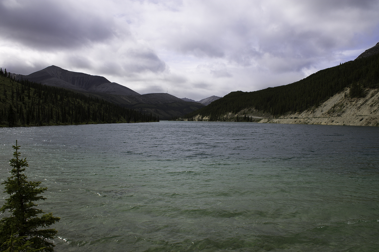
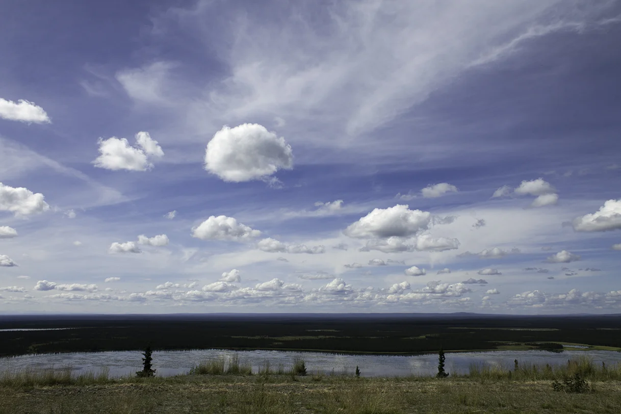
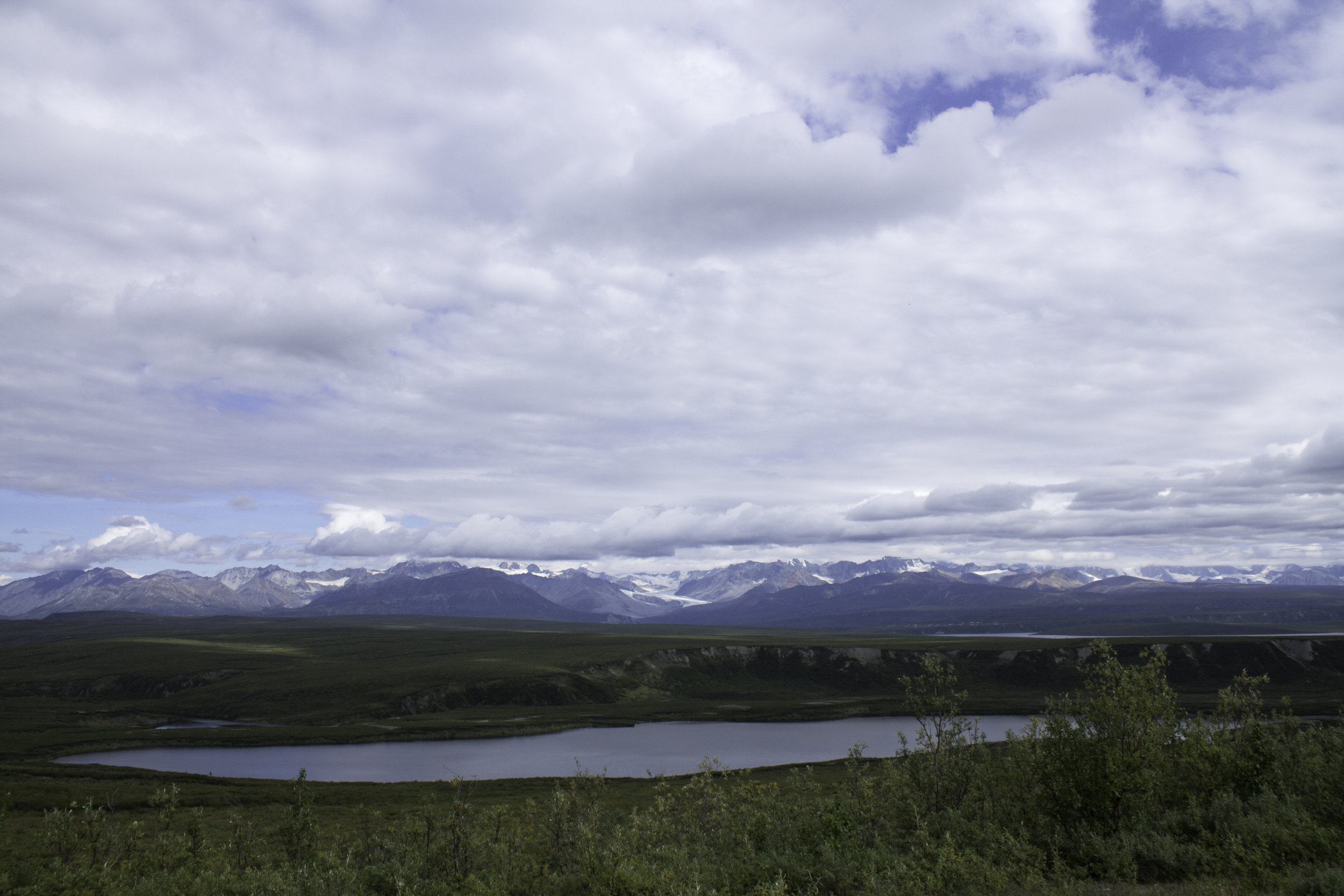
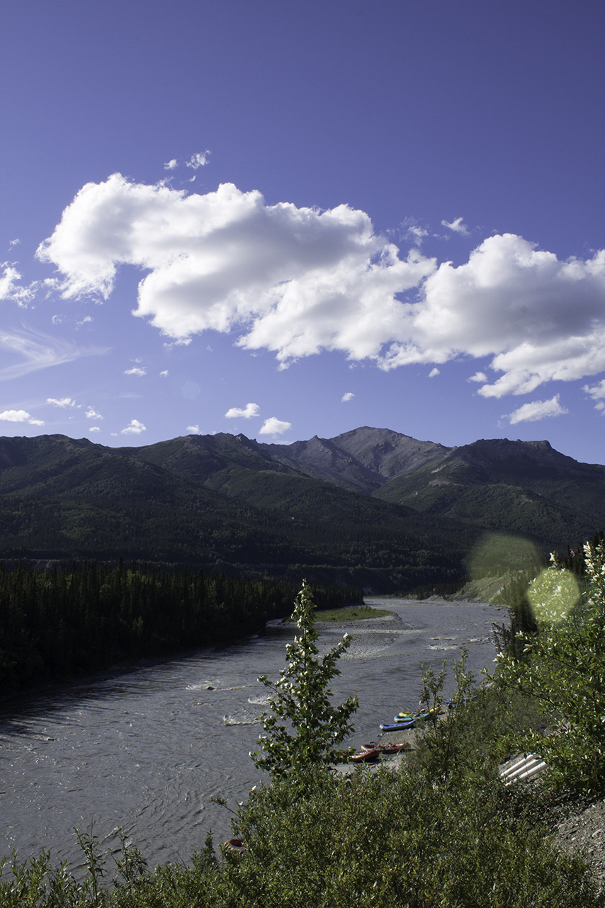
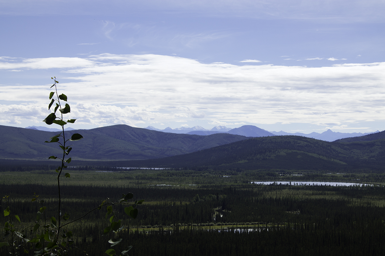
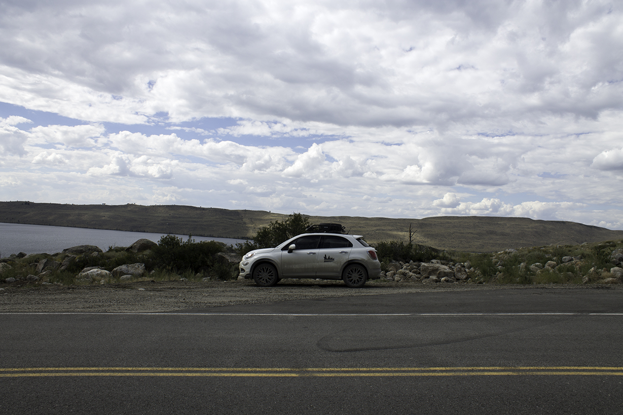
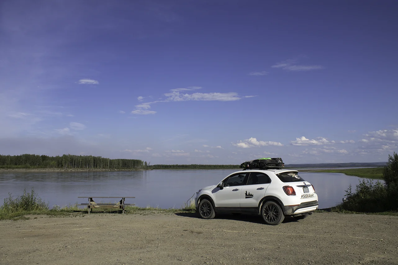
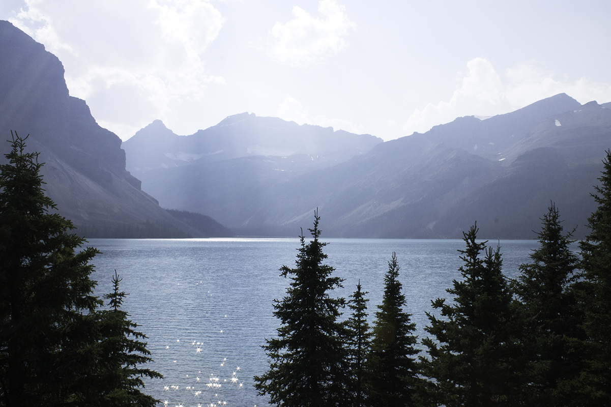
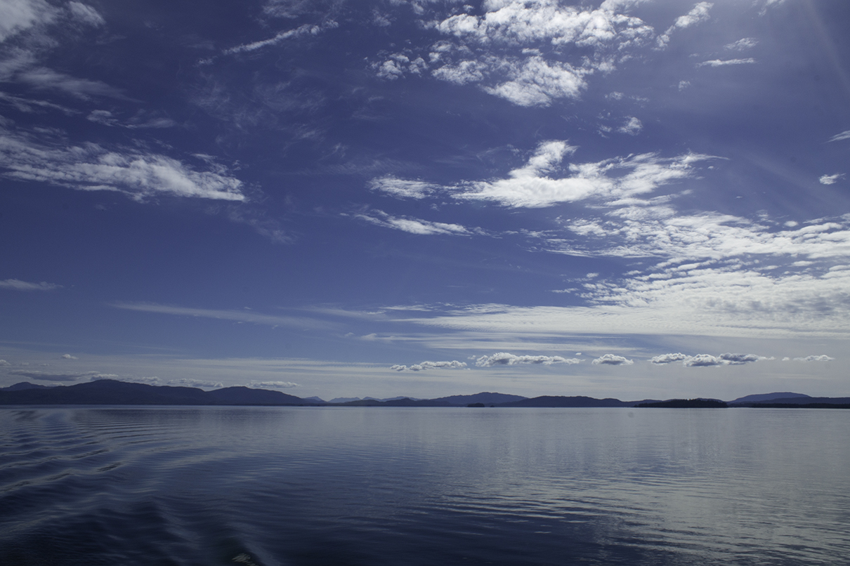
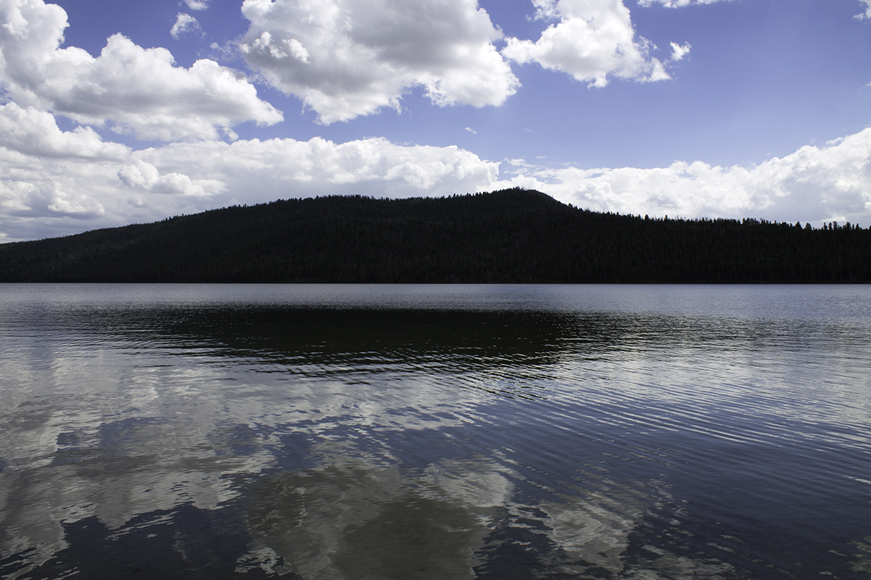
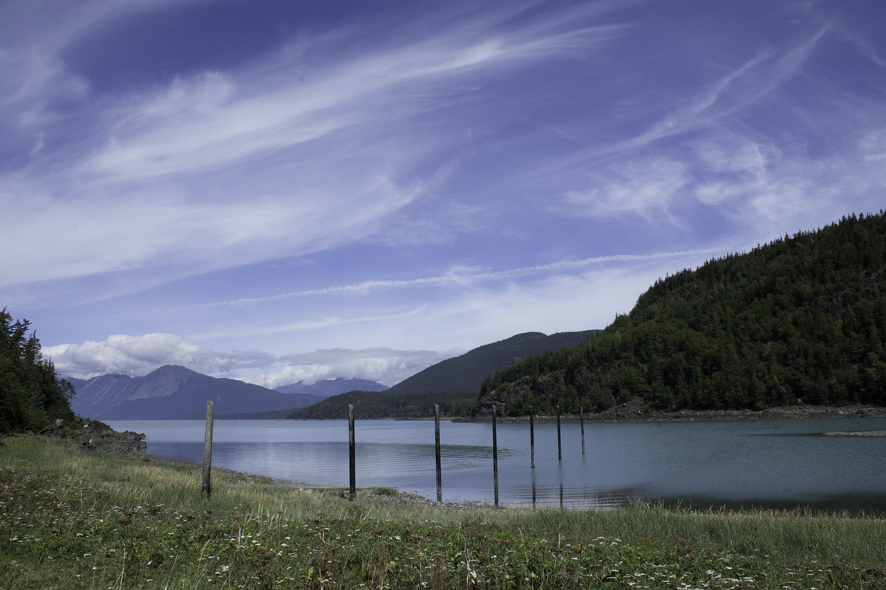
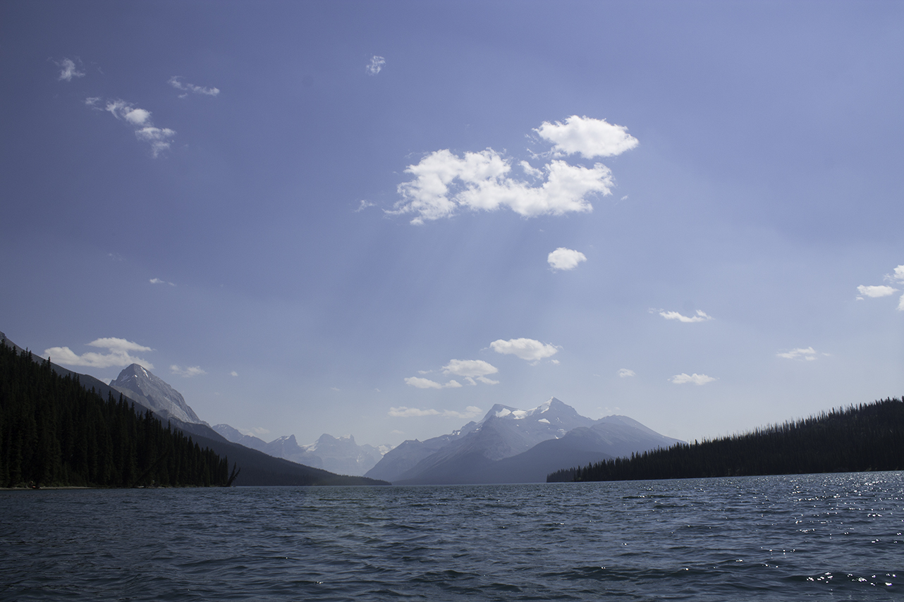
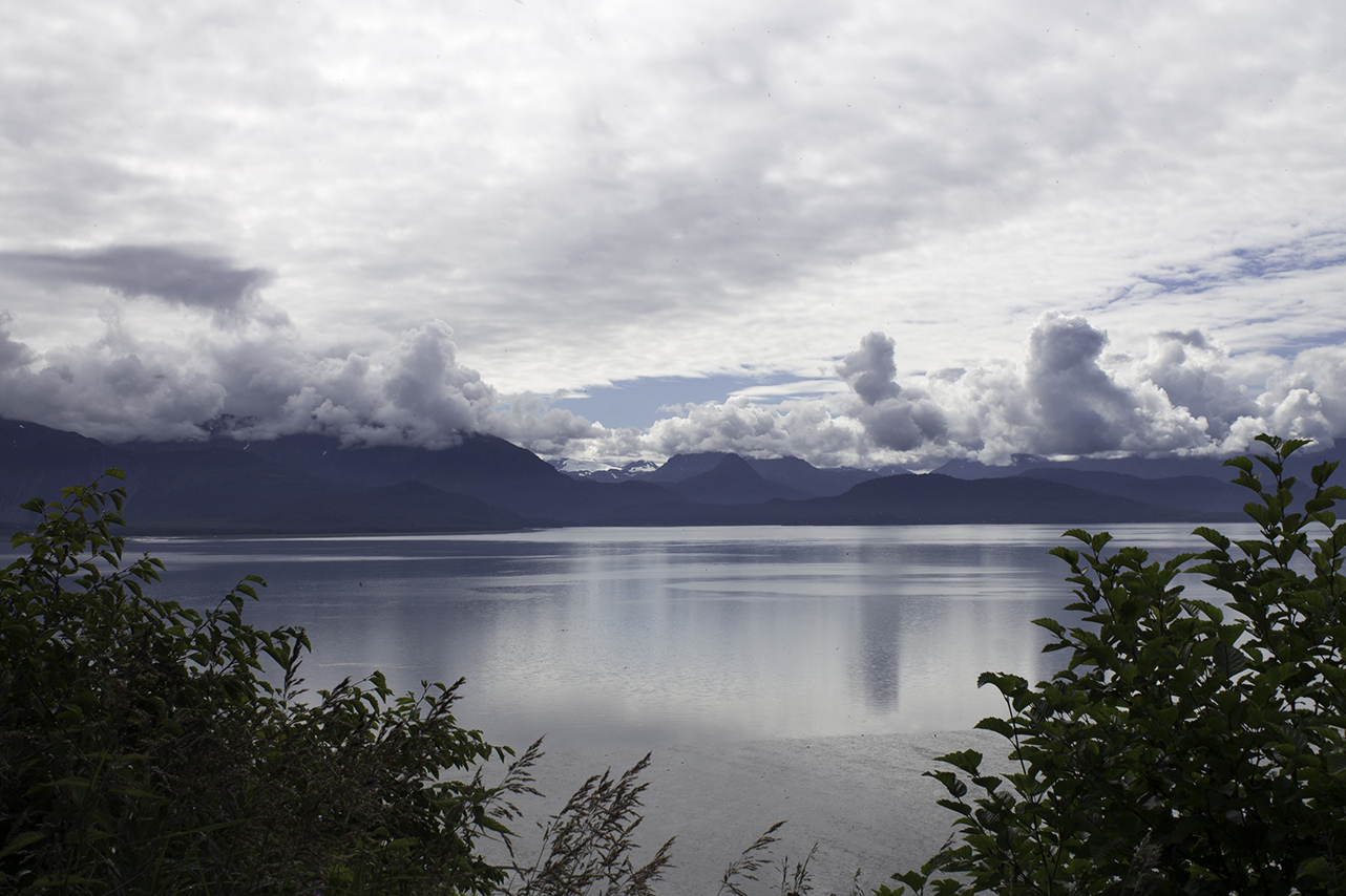
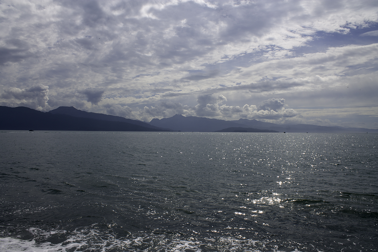
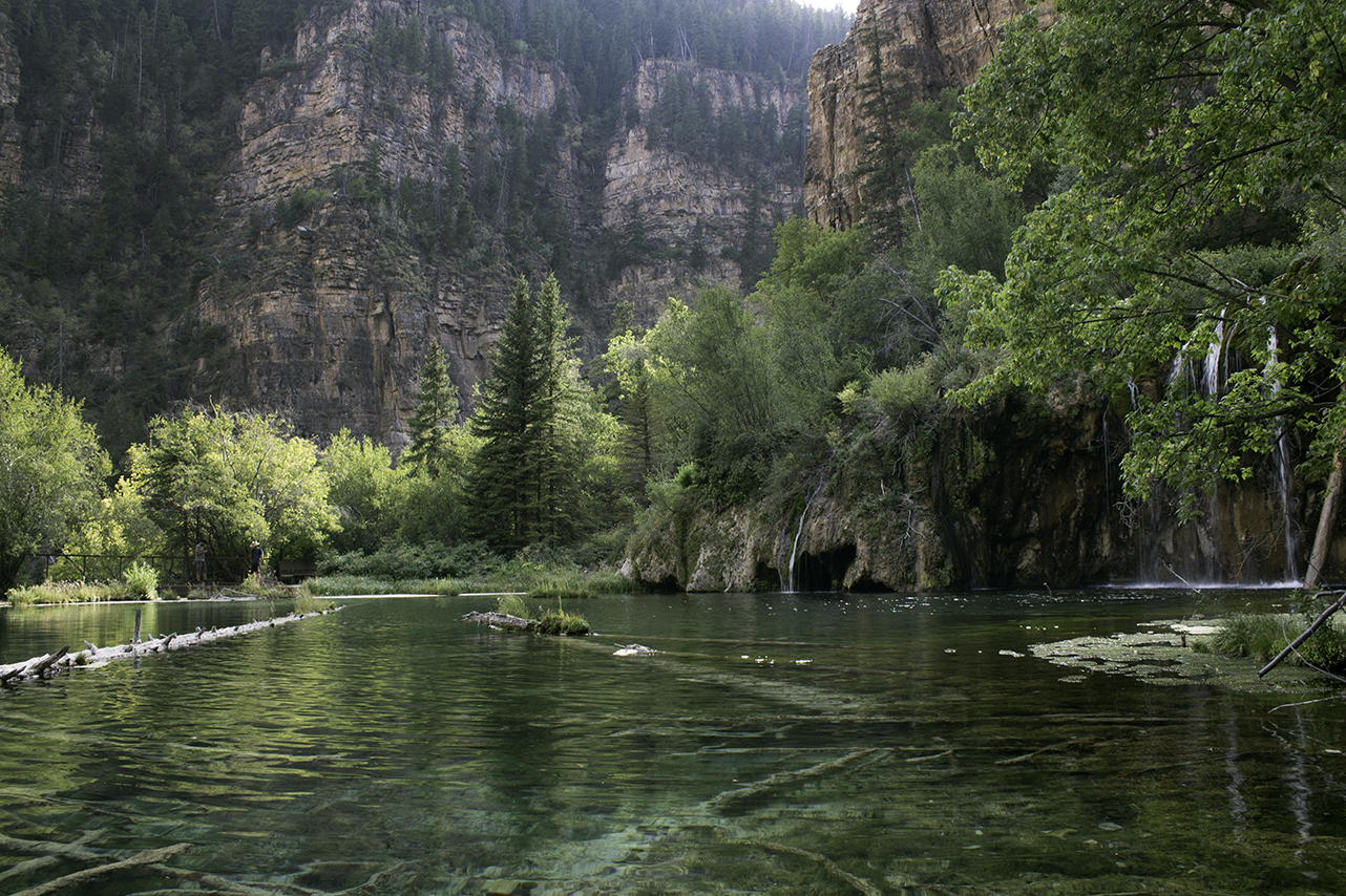
4. There are a lot of lakes, WATERFALLS, rivers, bays, creeks...

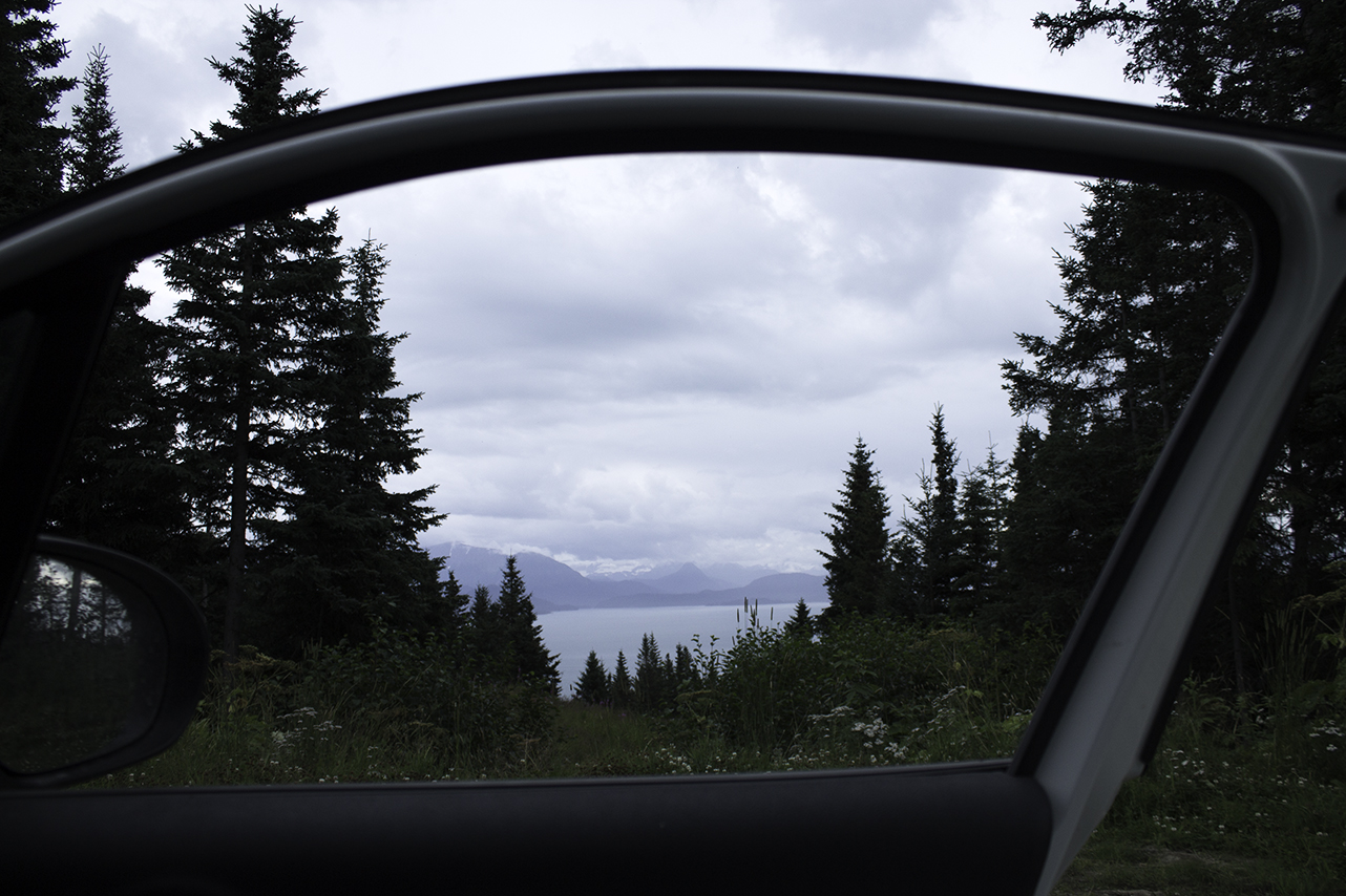
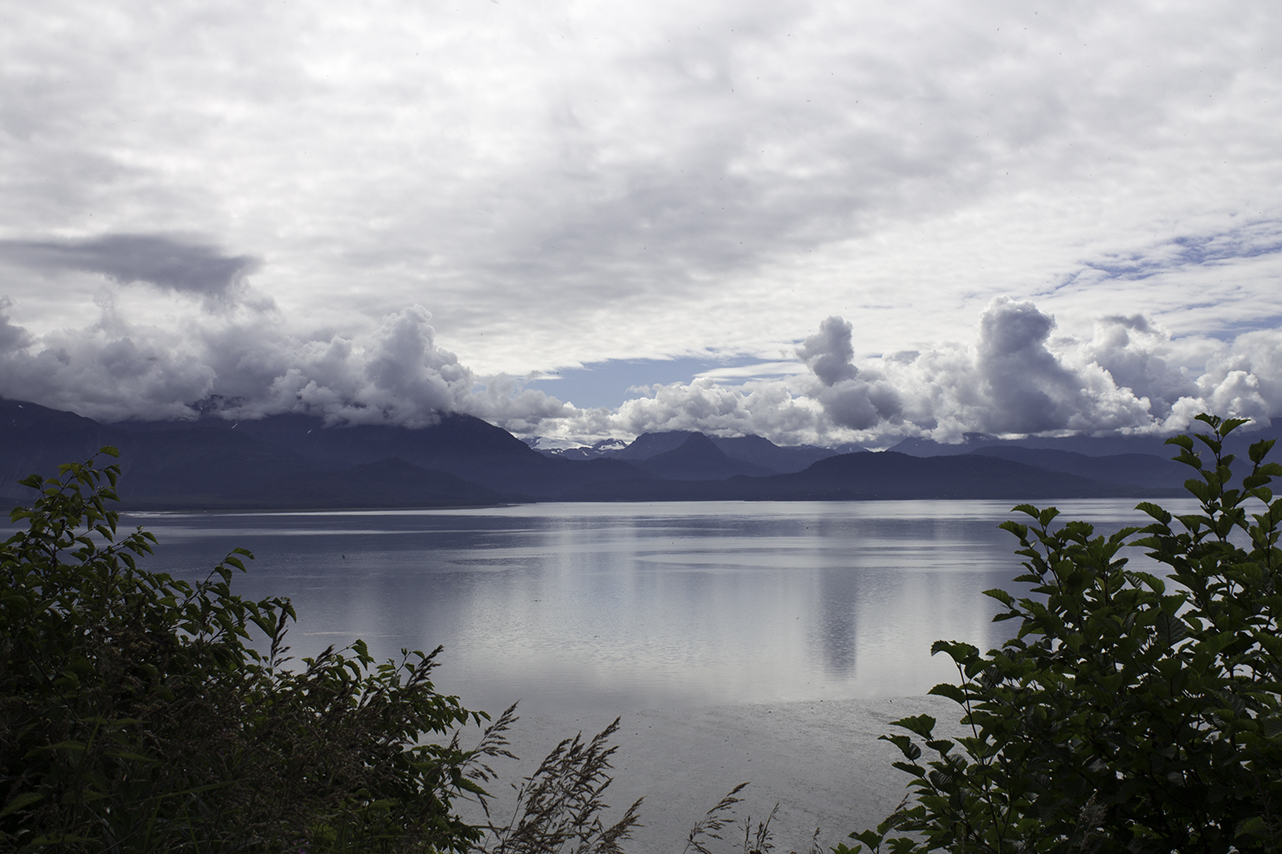
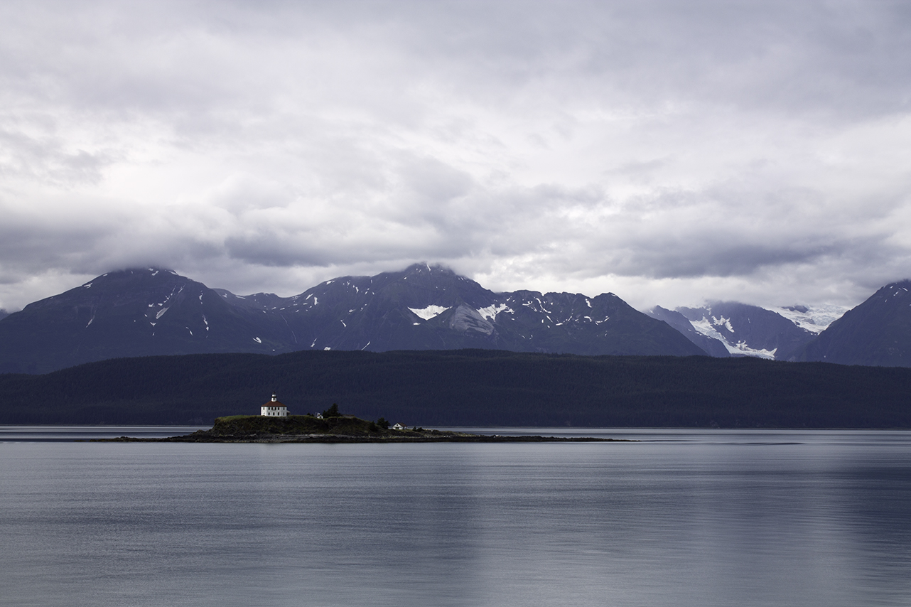
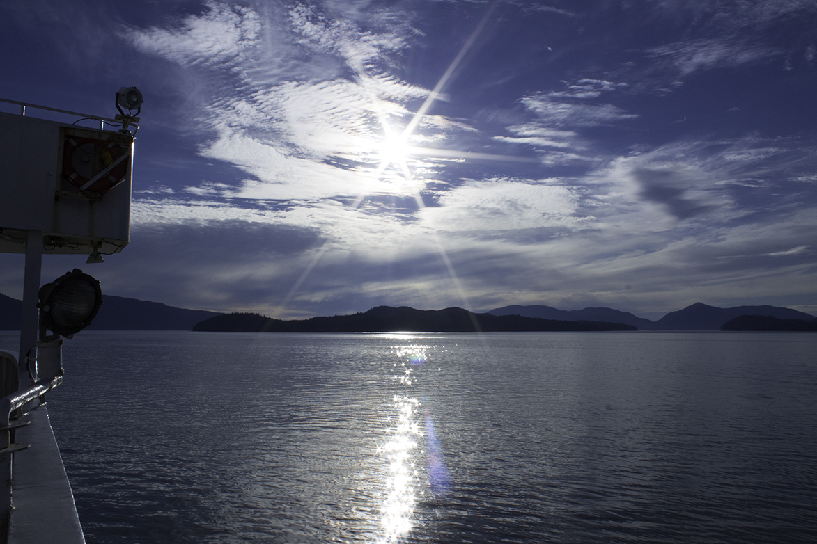
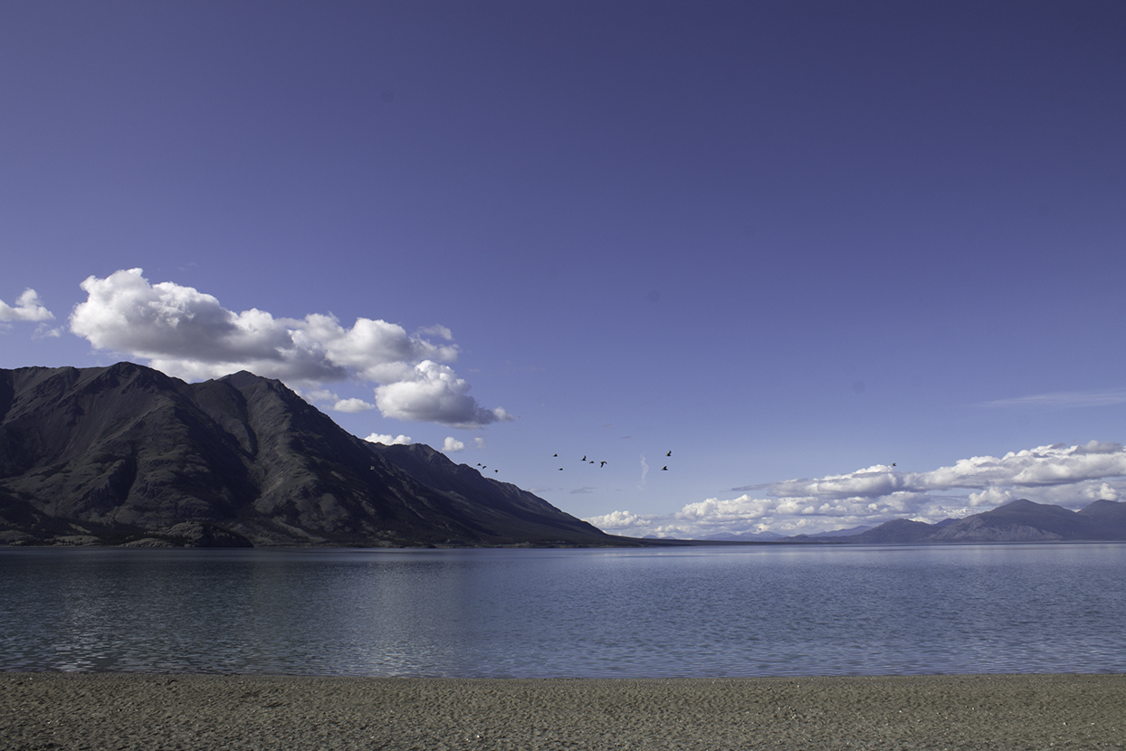
And the list goes on. It sounds silly, but it did teach us something: there's no peace quite like the kind you find looking out on a body of water. We took in the sparkling waters of Maligne Lake from a canoe. We sat on a rocky beach on the Homer Spit. We stood waist-high in the tranquility that is Half Moon Lake. And then there was sheer perfection of the Inside Passage—the cold, glassy waters rippling in the ferry's wake. 

Bow Lake
Bow Lake
Inside Passage
Inside Passage
Half Moon Lake
Half Moon Lake
Chilkat Lake
Chilkat Lake
Maligne Lake
Maligne Lake
Kachemak Bay
Kachemak Bay
Kachemak Bay
Kachemak Bay
Inside Passage
Inside Passage
Inside Passage
Inside Passage
Athabasca Falls
Athabasca Falls
Chilkat River
Chilkat River
Muncho Lake
Muncho Lake
Kluane Lake
Kluane Lake
Hanging Lake
Hanging Lake

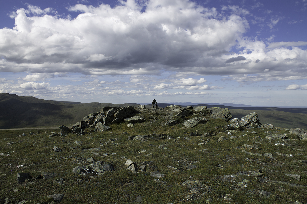
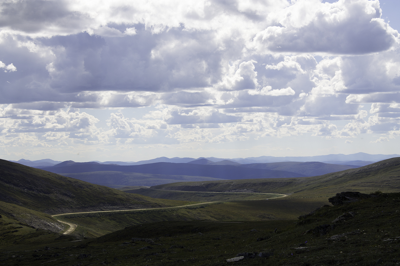
5. There's a lot we didn't know.

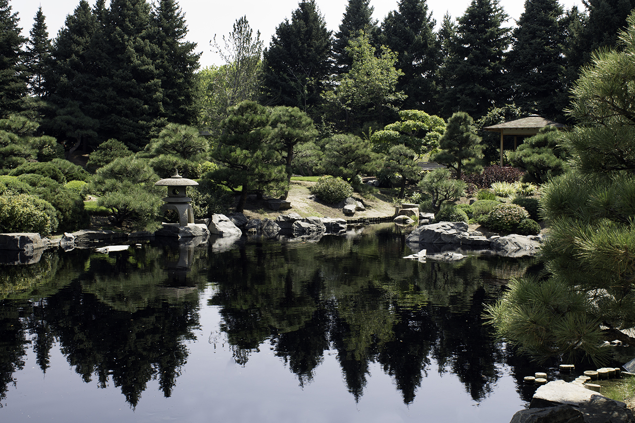
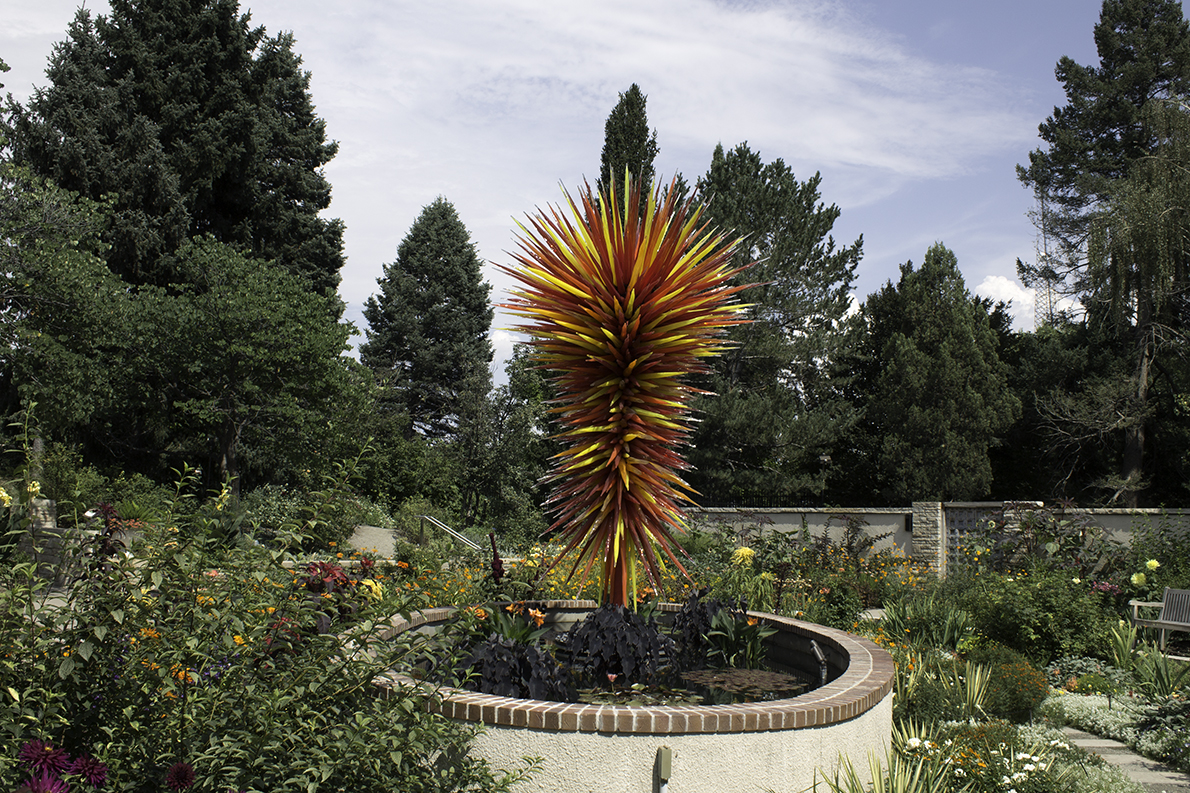
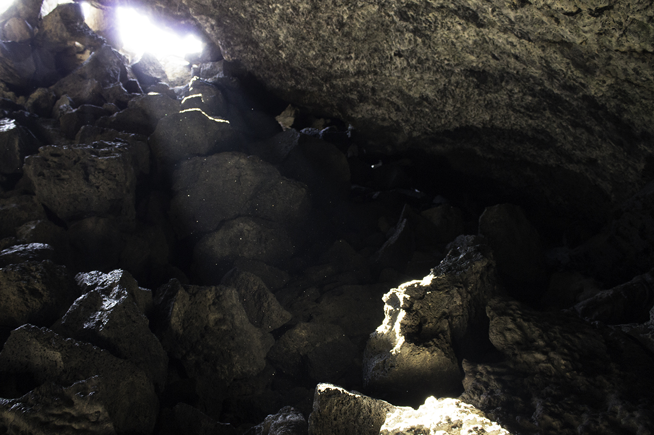
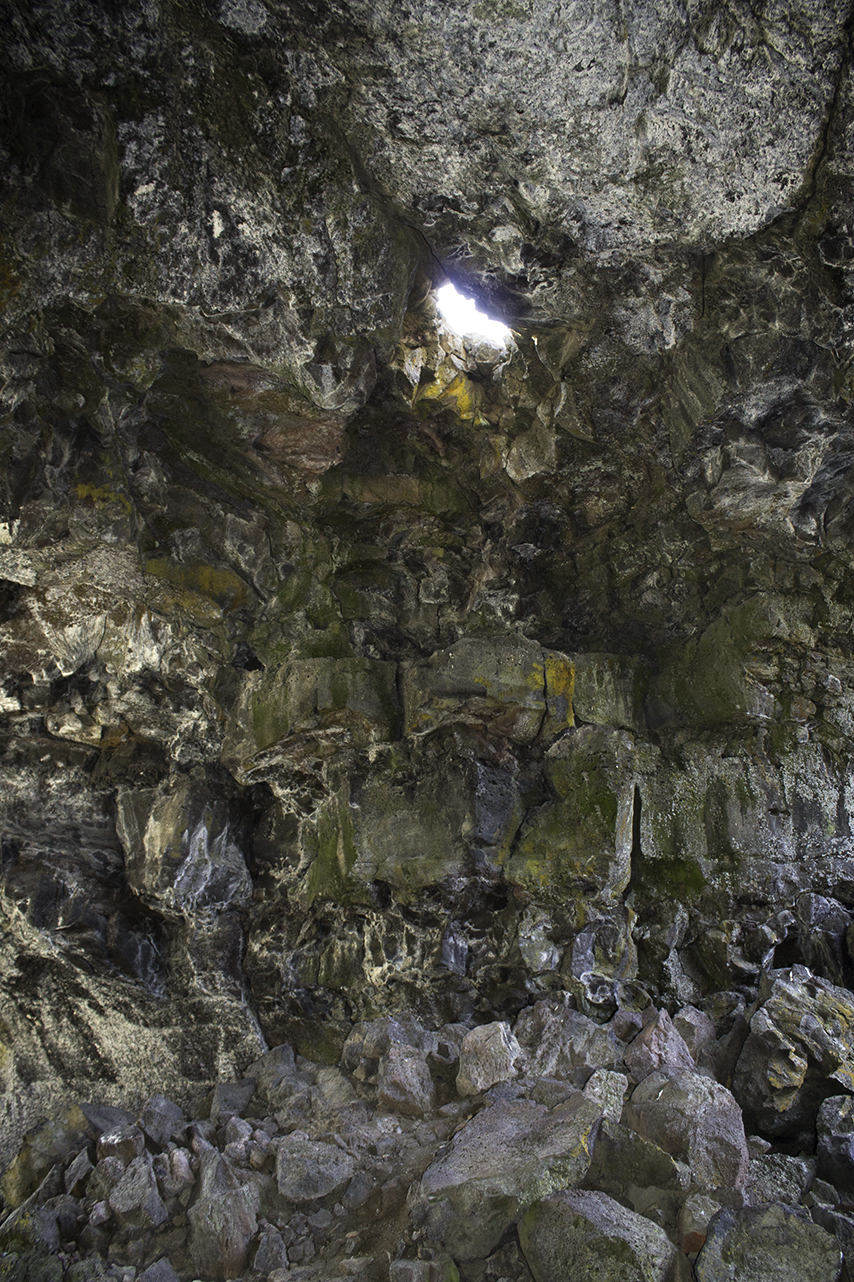
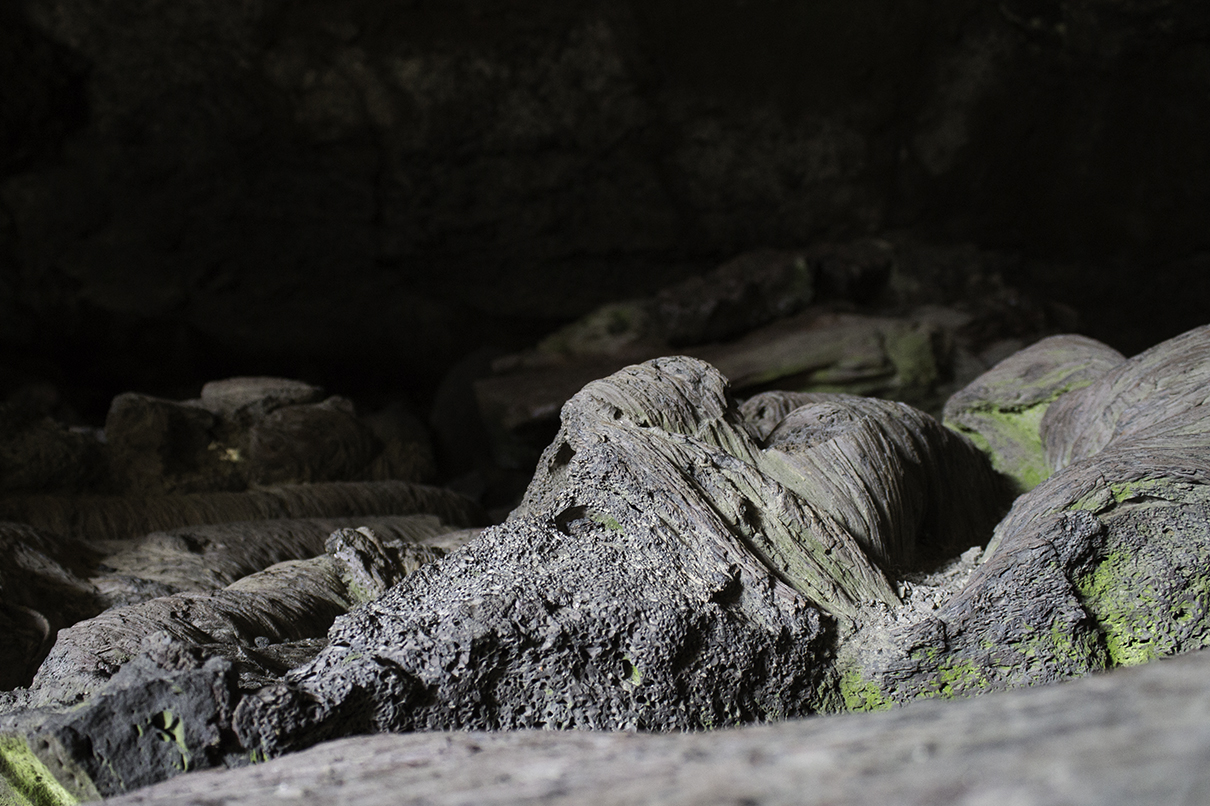
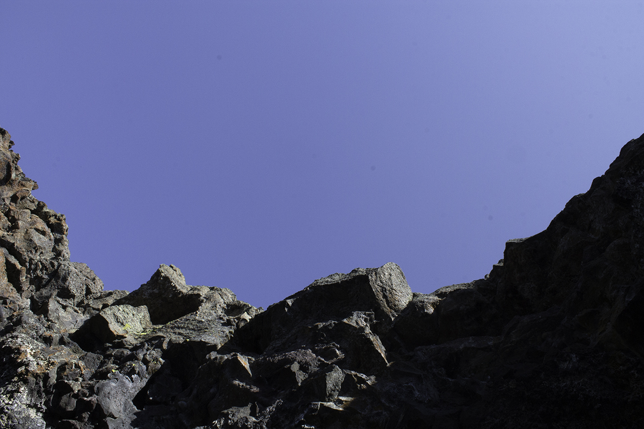
Which is probably evident from this list. For example, we learned there are four different kinds of Alaskan salmon: king, coho, sockeye, and pink. We learned about lava tubes, the Northern Lights, the wonder that is qiviut, and the different kinds of glaciers (there are way more than you think there are). We realized that we didn't really understand bonsai before our trip to Denver. We found out the hard way that driving through the Yukon Territory late at night without a reservation means you will be sleeping in your car. Also, driving through popular national parks at the height of the season will make you want to leave. We learned (again) how important it is to have a trail map when you're hiking. Also, if you're taking the Alaskan ferry, don't forget your sunscreen on the car deck. 

And we learned that there is a lot more to see. 

September 04, 2017 /Rita Fisher
#500xalaska

Day 43: Omaha, NE to Chicago, IL

September 02, 2017 by Rita Fisher

It was not without a little sadness that we set out today, the very last day of this amazing adventure we've been on. It's a bit of a blur at times, the amount that we've seen (and yet, how much is left to be seen!). Our drive began in slow motion, surrounded by spacious, sometimes-tedious landscapes. And then, half-way through, the whole thing went into warp speed. A few minutes thinking about the trip and—bam—just like that, we were on the outskirts of Chicago.

After spending quite a bit of time removing our lives from every nook and cranny of the car, we said our goodbyes. It's almost become a bit of a mascot on the trip. I think it will be a few days before we stop looking for it in parking lots and scoping out good places to take a picture of the old girl. But before we wax nostalgic for too long, we'll move on to a grand conclusion post with some of our collected thoughts on the car, the journey, Alaska, and everything in between.  

Goodbye500X
September 02, 2017 /Rita Fisher
#500xalaska

Days 41-42: Denver, CO to Omaha, NE

September 01, 2017 by Rita Fisher

The next day, we set out from Denver in the early afternoon for Boulder, where we'd be seeing an old friend for dinner before we finish the last leg of our journey back to Chicago. As is our routine now, we found a last-minute Airbnb and settled in, walked around the neighborhood a bit, then headed over to Pearl Street to take in Downtown Boulder. We picked up a quick lunch from Spruce Confections and walked around a bit. Despite our failure to take, well, any photos of Boulder, it is a pretty sweet city and is definitely worth more time than we could spend there (and we will be back someday!). We met our friend over at Verde for some tasty tacos and margaritas, then said our farewells and went home for the night. 

The next day brought some pretty uneventful driving. Once you get out of the mountains, that last part of northeast Colorado is pretty flat, followed by a whole lot of Nebraska. We tried really hard to get something out of the ride across 80, looking up things along the way and even digging up an old New York Times article from 1990, "I-80's Exits To History In Nebraska." And yes, it is a historic passage crossed by prehistoric tribes, European trappers, early settlers and hordes heading west to find gold. But driving across it, you kind of wonder if they all found it equally monotonous. 

The plus side of all that nothing, however, is a crazy line of sight, not unlike what we experienced up in Alaska and the Yukon Territory. When it's clear and sunny, the expansive landscape makes you feel very small. When the weather turns, the landscape becomes a giant 3D weather map where it seems you can actually see a system develop and turn and pour down. So, that occupied the last part of the drive, along with a few minutes of a crazy, beet-red sunset on the horizon. Through Lincoln and into the outskirts of Omaha (another city we'd really like to see more of at a later date), we arrived at our room for the night in pitch darkness. 

After a very long day of driving, we finished the day off with a walk over to Modern Love for another one of our favorite meals of the trip. And if you can say that about takeout, you know it's damn good food. The space is simple and cozy, complete with a lively game of beach volleyball going on just outside. 

September 01, 2017 /Rita Fisher
#500xalaska

Days 39-40: Edwards, CO to Denver, CO

August 30, 2017 by Rita Fisher

After a few excellent days in Edwards, we decided we should probably get back on the road and at least get a little bit further east. We didn't get that much further, only a couple hours over to Denver, but we wanted to check out the city. After an easy, scenic drive, we made our way over to the super Airbnb we'd found right off Colfax, not far from downtown Denver. We got everything settled in and picked up a late (but delicious!) dinner from Native Foods. 

The next day we started with a trip over to the Denver Botanic Gardens, just as they were setting up for the Gypsy Kings concert. The gardens are lovely, easy to cover in a couple of hours and filled with interesting little corners to explore, like the small-but-interesting succulent house, which doesn't appear to get a lot of traffic, or the delightful little solarium in the Woodland Mosaic section, seen below. 

In addition to their fairly large Japanese Garden, we also checked out the Bill Hosokawa Bonsai Pavilion—and realized we definitely didn't really understand Bonsai until now. Their collection includes several native species to Colorado, like a twisted little blue spruce and ponderosa pine, as well as a small greenhouse of more tropical variants. 

We spent more time than we thought we would in the Science Pyramid, which is packed with super-interactive exhibits and models, then continued on through the gardens. Their current exhibit of Calder sculptures are interesting, but the Chihuly glass (seen in the slideshow below) outshines them with ease. Side note: we were lucky enough to catch the Chihuly at the Atlanta Botanical Gardens not long ago, and any time there's a huge exhibit of his work, especially in a botanic garden, you should go.

Inside the tropical conservatory
Japanese gardens
Japanese gardens
"Colorado" by Chihuly
The Science Pyramid
The Science Pyramid
View fullsize 083017_013_DenverBotanicGardens.jpg
View fullsize 083017_008_DenverBotanicGardens.jpg
View fullsize 083017_010_DenverBotanicGardens.jpg
View fullsize 083017_006_DenverBotanicGardens.jpg
View fullsize 083017_015_DenverBotanicGardens.jpg
View fullsize 083017_009_DenverBotanicGardens.jpg

We spent some time driving around Denver, getting to know the neighborhoods and driving by the iconic capitol building, then stopped at City O'City for an early dinner. And, let me tell you, it was one of the most delicious meals we've had on this trip—in a cool space complete with work by rotating artists, like the hypnotizing set of prints from RUMTUM currently adorning the walls. 

We finished the night off with a walk/drive around the Rocky Mountain Arsenal National Wildlife Refuge, one of the largest urban refuges in the country. Our walk began with a small group of deer loping across the fields in front of us (above), so pretty idyllic overall. It's large enough that you can, in some spots, begin to forget the huge city nearby. Then little hints of humanity and city life peek out on the horizon—in fact you can actually see the Denver skyline in the photo of the car below.

083017_019_RockyMountainArsenal.jpg

Once it grew darker, we hopped back in the car and returned to our Airbnb for the night, already planning our next little jaunt (hello, Boulder!) in the morning. 

August 30, 2017 /Rita Fisher
#500xalaska

A few of our nightly visitors

Days 36-38: Edwards, CO

August 28, 2017 by Rita Fisher

Thirty-five days on the road have a way of putting some things into perspective. For example, having a large sink to wash dishes in is quite the luxury—not to mention a dishwasher. Beyond all that, though, is the feeling of waking up and not having to rush out the door. No need to check out by 10:00 a.m. No need to pack up a campsite. Not that we're complaining about a month-long road trip, but being able to settle in somewhere is a luxury we just hadn't anticipated. 

So, we spent the next three days in a house at the very top of Edwards in Cordillera, reveling in the views and the space and 72 hours without much driving. Here are the highlights: 

Hike to Big Park. At the very top of the mountain from where we were staying (somewhere above 9,000 feet), a trailhead gives you access to White River National Forest. More specifically, Big Park, an alpine meadow with sweeping views of the surrounding mountain ranges. It was originally billed as a quick and easy hike, which it was, so we decided to press on past the meadow and see where the trail would take us. And, wow, we really outdid ourselves this time. The photo below shows you the edge of the meadow, where the trail carries on down. 

Though relatively well prepared with a pack and good hiking boots and plenty of water, we didn't actually have a map of any of these trails. So what could have been an hour-long meander up to a meadow and back became close to 4 hours, a hell of a lot more climbing, and a large chunk near the end with no trail at all... which is pretty unadvisable, if for no other reason than an effort not to disturb the wildlife. 

Up at Big Park we were somewhere around 9,600 feet. The trail we had chosen started to decline rapidly, which we knew we'd have to pay back eventually. We got down to about 8,500, then found a trail that we hoped would take us back in the right direction. It did, for a minute, then not as much. We walked along berry-covered ridges, through meadows and groves of towering aspens. Though we were a little late for the wildflowers, there were still some here and there, and the forest more than made up for it with the occasional burst of yellow from an aspen getting ready for fall. 

082717_005.jpg
082717_006.jpg
082717_007.jpg

We finally made our way up a dirt road to the very top. From there we managed to navigate a little closer to our original trail, then the aforementioned trail-free forest walk back to where we started. That last part was a bit of an obstacle course—climbing over a web of fallen trees at the end of a long hike will really make you value a nice, well-trod trail.  

Hike to Hanging Lake. The next day, we back-tracked a little over to Glenwood Canyon, where there's a short but fairly rigorous hike up to Hanging Lake. "A geologic fault which caused the lake bed to drop away from the gently sloping valley above it," resulting in a truly beautiful lake fed by Bridal Veil Falls, tucked into the surrounding trees and braced by the mountains around it.

The hike to the lake is pretty popular—so much so, in fact, they're in the process of limiting the number of daily visitors to 615 in an effort to protect the fragile ecosystem around the lake. The trail itself alternates between wide dirt paths and stretches of steep, rocky terrain. It cuts back and forth as it rises, using a series of seven bridges and even a small section with handrails as you get closer to the top. The view at the top is just as lovely as the photos would suggest. There's a nice stretch of boardwalk around the lake for visitors to peer down into the emerald water, where every now and then a trout swims by. 

And just in case you missed the shots of driving through Glenwood Canyon in our last post, we're going to go ahead and give you another chance:

Nightly Visitors. And when we weren't driving and hiking and getting slightly lost, we were doing things like hanging out with our nightly visitors (seen at the top of this post), the small herd of deer that seem to have taken up residence along one side of the house. So, we left the GoPro out one night and took a time lapse of their evening ritual, because who said the GoPro should only be used for driving through canyons and mountains? You may want to make this one full screen to see them best. 

August 28, 2017 /Rita Fisher

On the road south of Rock Springs, WY

Day 35: Half Moon Lake, WY to Edwards, CO

August 25, 2017 by Rita Fisher

We packed up our campsite and started south, but rather than head east toward our final destination for the day, we took a different route through the corner of Utah first. South of Rock Springs, the road started to curve and climb, bordered by long stretches of snow fences and opening up to giant, rocky vistas that required more than one pit stop to take it all in, as seen in the second photo below.

082517_001_GoPro.jpg
082517_006_RockSprings.jpg

We had toyed briefly with the idea of stopping and camping for one more night, somewhere near the Flaming Gorge National Recreation Area, but lack of a shady campsite and the above-90º weather made it an easy decision to press on, taking in as much of the landscape as we could from the car (and vowing to come back someday in the future). We drove through the southern section of the Flaming Gorge area, crossing over the Flaming Gorge Dam and Cart Creek Bridge (below). Both can also be seen in the video at the bottom of this post. 

Shortly after that we crossed the border into Colorado, passing through the town of Dinosaur (just south of Dinosaur National Monument) and making our way south toward 70. We're not sure if we missed a turn or if Google Maps was just trying to spice up our route, but this leg of the journey was on a beautifully empty dirt road that seemed to go on and on, covered in sagebrush and painted in golds and greens by the sun. But, truly, there was nothing on this road. Though slightly confusing, it wasn't a bad little detour of sorts. 

The drive down 70 through Glenwood Canyon is easily one of the most impressive and beautiful stretches of road you can drive down in the U.S. We'd been down it before, years before, but both felt a renewed awe faced with 2,000-foot canyon walls on either side of the roadway along the Colorado River. Tunnels and bridges weave through the canyon, dotted with rest areas that provide access to hiking, biking, rafting, and a recreational path through the canyon. 

082517_007_GoPro.jpg
082517_008_GoPro.jpg
082517_009_GoPro.jpg

As we drew closer to Edwards, we quickly discovered that Google Maps had once again led us astray—they had somehow missed the memo on several roads up the mountain that didn't appear to have been open for quite some time... But, even more beautiful dirt roads and the golden hour sun made it slightly more acceptable than we'd usually find an hour-long detour to nothing. We corrected our route and made our way up the mountain for the night, more relieved than ever to be done with a long day of driving. 

August 25, 2017 /Rita Fisher
#500xalaska

Days 33-34: Craters of the Moon NATIONAL MONUMENT to Half Moon Lake, WYOMING

August 24, 2017 by Rita Fisher

The next day we got up and enjoyed some breakfast with the remaining campers, until the rain put an abrupt end to that. We said our farewells, and got on the road toward Victor, Idaho, where we had a glamping tent (another first!) reserved for the night. The drive from Craters of the Moon to Victor was pretty calm, carrying us back through Arco and on through Idaho Falls, almost to the border of Wyoming. We rolled into Moose Creek Ranch mid-afternoon and took a look around, then found our way to the back of the property, over a little footbridge, to our wood-sided tent, right on the edge of Moose Creek. The cabin/tent is pretty ingenious—complete with windows, doors, and a wood-burning stove, but a canvas roof that lets you hear the wildlife and the rushing waters of the creek as you sleep.

All checked in, we hopped back in the car and crossed over into Wyoming. We decided to take a drive through Grand Teton National Park, making a few quick stops along the park's loop road. The weather was less than ideal, but the park was no less beautiful with dark clouds rolling over the Teton Range. We made a quick stop by the Jackson Lake Dam (below), then continued on toward Jackson. 

82317_001_CarByDam.jpg
82317_002_Road.jpg

After battling through the slightly painful traffic to get from Grand Teton to Jackson, we took a walk through the downtown area, which was pretty lively for a rainy Wednesday evening. We stopped by Jackson Whole Grocer (two thumbs up) and then made our way back to to Moose Creek Ranch to make some dinner and enjoy our (now super dark) cabin/tent. 

The next day we got up bright and early and hit the road. Our friend Jeanne from Craters of the Moon had told us about a few different camping options along our route, and we were pretty committed to finding a good spot at one of them (most of which were first come, first served). The drive was composed mostly of roads through tree-covered mountains and funny little towns, ending in the town of Pinedale, the gateway to the Wind River Mountains. We've come across some funny/interesting town mottos over the course of the trip, and Pinedale was definitely up there: "All the Civilization You Need!" And it does have just about all that you need, including a perfect campground just outside of town and down a little dirt road.

Past the much larger Fremont Lake, we found Half Moon Lake Campground (actually a little shy of the campground we'd been directed to). We found a perfect spot in the trees, not too far from the little sandy beach of Half Moon Lake. We set up camp and headed down to the lake, just a few minutes walk. The lake is very calm and very beautiful, with one of those super-reflective surfaces that shows the tree-covered slopes around it. Best of all, it was very empty, with just a few others out enjoying the little sandy beach.

We went for a swim, then headed back to the car to get some supplies in Pinedale. On our way, we stopped at a turn-off and climbed up to the ridge overlooking Fremont Lake for a better view (see below). We picked up a few things in Pinedale, then headed back to our campsite to build a fire and cook up some dinner before calling it a night.

On a ridge overlooking Fremont Lake (below)

On a ridge overlooking Fremont Lake (below)

View fullsize 082417_004_Ridgeline.jpg
View fullsize 082417_005_FremontLake500X.jpg
View fullsize 082417_006_FremontLake.jpg
August 24, 2017 /Rita Fisher

Day 32: Bellevue, ID to Craters of the Moon National Monument

August 22, 2017 by Rita Fisher

After a very comfortable evening in Bellevue, we got packed up and got on the road to the Craters of the Moon National Monument. Neither of us had ever heard of it, but after seeing such an intriguing name on the map, we decided to check it out. After all, we hadn't come across too many campsites next to giant lava flows and cinder cones.

The drive was pretty quick and uneventful, and then became rapidly more interesting as we drew closer to the Craters of the Moon. You instantly notice something is different as the landscape shifts from crops to expanses of crushed black rock, dotted with sagebrush and cinder gardens. The whole park/preserve centers on the Great Rift, from which lava erupted multiple times between 15,000 and 2000 years ago, creating a vast ocean of lava flows scattered with cinder cones. The road through the park is a loop, with stops at the major cones and overlooks, ending with a series of four caves. 

Craters of the Moon National Monument

The short drive and early arrival meant we had half a shot at actually getting a campsite—all of which were first come, first served and apparently in fairly high demand. Finding one seemed fairly hopeless when we first arrived, but we decided to try our luck and... found a spot!

OurCampsite

We set up our tent (grateful for the little bit of shade a nearby tree provided), met our very nice neighbor, and got back in the car to go see some caves. The 1.6-mile trail to the caves is a wonder in and of itself, a narrow black path that rises, falls, and turns through massive lava fields. It's so otherworldly it begins to feel almost manufactured, but then you walk by a massive crater that appears to have just cracked open and it all feels very real once again.

Craters of the Moon

There are four caves to explore, each formed by lava tubes. The sign at the trailhead explained it best: "Below ground there is a dynamic underground world where fiery rivers in hardened, self-insulating tubes once flowed for miles without losing heat." Now, the caves remain as record of the rivers of lava, the rock inside carved and dripping and a little hard to fathom. 

We somehow managed to begin with the most difficult cave, Boy Scout Cave, which could elicit some form of claustrophobia in just about anybody. Essentially it is one long tube with a collapse in the middle that forms two small entrances going in either direction. Of the four caves, this is the one you definitely need a flashlight for. We scooted our way down into the opening (really a four-foot crawl space) which then led into a very dark, very small chamber, where everyone must spend a moment thinking, "Did I go the wrong way?" There didn't seem to be a way to move forward, and then we realized the cave goes down to about a one-foot opening. We managed to crawl through that part as well, dragging the pack by foot, until the cave opened up large enough to sit down with a little head room. And then, we sat, just taking in the cool, dark silence and catching our breath. Thankfully, the little bit of light peaking out at the end of the tunnel was a rear entrance, so we crawled our way out and back into the blazing heat of day. 

The light at the end of Boy Scout Cave

We followed that up with Beauty Cave, which was a whole lot easier to get into. There wasn't as much to explore in Beauty Cave, but the walls inside glisten and the interior has the same deep, dark, cold silence, just with a little more space. We followed that up with Indian Cave, the largest and most accessible of the caves. It’s about 30 feet tall inside, stretching out for some 800 feet. The ceiling above you opens up into massive skylights here and there, giving you enough light to look more closely at the walls and the layers of rock around you. Near the end, there was a bit of climbing up to a skylight where you could exit the cave, popping out of a little cutout in the surface.

The walls of Indian Cave
Skylight in Dewdrop Cave
Skylight in Indian Cave
Rock structures in Dewdrop Cave
Skylight in Indian Cave

We finished our cave tour with Dewdrop Cave, which was small but very interesting. With plenty of room to stand up, you could look around a bit in this one. It had some of the most interesting rock formations, plus solid beams of bright light from the entrance above. 

We decided to climb up to the top of Inferno Cone before heading back to camp. At first glance it reminded us a bit of our trip to the Great Sandhills in Saskatchewan, but instead of soft, flour-light sand, the hill was pure black. It was caused by a volcanic eruption flying high into the air and piling into a mound nearby (so the vent that expelled these cinders was actually somewhere near the parking lot).

InfernoCone
View fullsize 082317_009_Cairn.jpg
View fullsize 082317_010_Tree copy.jpg
View fullsize 082317_012_DeadTree.jpg
View fullsize 082317_017_OnTopofCone.jpg

The climb up was short but pretty steep, but the views from the top were worth it, allowing you to see the Great Rift and the other cinder cones pretty clearly. We spent a little sitting under what appeared to be the only living tree, marveling at the other trees that now stood dead, twisted, and wind-whipped to a smooth finish. They’re unbearably beautiful and creepy.

Craters of the Moon - Dead Tree

We made our way down the cone and made a quick trip to Arco, the closest town to Craters of the Moon, for some fresh ice. Arco is small and unassuming, beyond the neon sign proclaiming Arco as the first city to be lit by atomic energy.

ArcoIdaho

We headed back to camp, where we found our little enclave of two campsites had grown to include two more. As night fell, everyone drew together around our new friend’s picnic table while we cooked some dinner. It’s really nice when things fall into place like they did, when people from all over settle in around a campsite over eight different conversations and a few beers. The night grew even darker, and then the string lights and candles came out, plus more snacks and a new arrival. As things wound down, we crawled into our tent at last and called it a night. 

August 22, 2017 /Rita Fisher
#500xalaska

Days 30-31: St. Ignatius, MT to Bellevue, ID

August 21, 2017 by Rita Fisher

Apparently last night while we slept there was a fairly large grizzly taking a midnight stroll around the property (the reason for the aforementioned bear fencing), munching on apples and stomping about. We learned a bit more from our host about the area and her farm, saw more of the cob house and her work, and then had to say goodbye to all of the animals and keep up our journey for the eclipse tomorrow! 

As far as our drive today goes, we were not prepared for how beautiful the drive would be—and especially unprepared for how beautiful Idaho is. Highway 93 takes you down through the Bitterroot Valley, which is dotted with historical markers about Lewis and Clark. Right around the border a sign tempts you toward a town called Wisdom (we'll have to visit next time), then the road crosses through the Bitterroot Range and into Idaho.

500XinIdaho

Highway 93 follows along with the Salmon River, winding through an unexpectedly gorgeous and untouched landscape, all the way down to Challis, where we took 75 into the Sawtooth Valley. As you get closer to the Sawtooth Mountains, there's that moment when you see their serrated peaks and smile at the name. Perhaps we just arrived on the right day at the right time, but the light is spectacular there, highlighting the valley in golds and greens. The road then leads into famed Sun Valley, but we'd be staying a bit further north to be closer to full totality. 

Map

The very nice folks at Smiley Creek sold us some very last minute (but cheap!) eclipse glasses and directed us toward Alturas Lake, a few minutes north, where the Forest Service had set up one of several eclipse viewing areas. You can see on the right where we stayed—almost at the center of the path of totality. Most of the campgrounds closer to the lake seemed pretty filled up, so we ended up setting up camp right there in the viewing area, where nothing could be in our way for the big show in the morning. And, in the end, there weren't many people in the viewing area, so it ended up being pretty perfect. 

When we woke up, there were a few more cars pulling in, but none blocking our view. We set up our chairs and got our glasses ready. We weren't watching the clock too closely, but we noticed suddenly a large group of little birds flying circles around the area, a little cyclone of tweeting that suddenly stopped, just as a fellow viewer shouted, "IT'S STARTING!" He proceeded to narrate the entire eclipse (probably more for the benefit of his family), which was mostly entertaining. 

Our campsite for the eclipse
360º sunset effect during eclipse
The eclipse viewing area

As we drew closer to totality, things got really weird, basically following everything we'd read: the sky grew darker, the temperature dropped, everything grew very still, and then it happened. All of the children around the viewing area let out little screams of confused delight, and there was a palpable giddiness throughout the crowd.

We could see what appeared to be solar flares and some planets. We even tore our eyes away from the eclipse for a minute to see the 360-degree sunset effect on the horizon, which was as beautiful as it was disorienting (you can see that in the photos above). After sitting in the blazing sun all morning, being in that cool, dim light was beyond soothing. 

And then, before we were really ready, totality ended with a brilliant flash (the diamond ring effect). You can see the flash in the iPhone time lapse on the right, just as the light gets brighter.


Eclipse.jpg
Before and during totality

Before and during totality

As things wound down, we finished packing up our campsite and said goodbye to the people around us, and headed down toward Bellevue, where we had a room booked for the night. In theory, this was perfect—we wouldn't have to drive very far in eclipse-related traffic. Except for one thing... we forgot a bag at the campground. And we didn't discover it until we were about an hour and a half south. So we drove back, just as a police officer was getting ready to take it in to the station. Grateful that we didn't have to track it down, we headed back down to Bellevue and settled in for the evening. We picked up some pizza from South Valley Pizzeria, which was surprisingly delicious. 

August 21, 2017 /Rita Fisher

Going-to-the-Sun Road in Glacier National Park

Day 29: Canmore, AB to St. Ignatius, MT

August 19, 2017 by Rita Fisher

After a lazy morning in Canmore, we got on the road and continued our trek down to Montana. The drive between Calgary and the border is pretty flat (see below), but we managed to stay awake for it, perking up for the odd little towns that dot the road. We completed our sixth and final border crossing, with our cheekiest border crossing officer yet, then made our way into Montana. 

081917_004_Drive.jpg

Beyond the benefit of getting to drive through the parks and see our friends in Canmore, our route also allowed us to drive the Going-to-the-Sun Road in Glacier National Park, touted as one of the most beautiful roads in America by many (and it did not disappoint). The route through the park is fairly astonishing. It’s 52 miles of mountain-hugging curves that pass by sub-alpine meadows and lakes, crossing the Continental Divide, and dropping you off alongside Lake MacDonald on the west side of the park. It was the first spot to have been registered as a National Historic Place, National Historic Landmark, and Historic Civil Engineering Landmark.

081917_001_Glacier.jpg
081917_002_Glacier.jpg
081917_005_Glacier.jpg
081917_003_Glacier.jpg

There are moments on the journey when you can’t help but ask why the hell they built this road—even though we were grateful they did. After just a few miles you realize what a feat it is, and how amazing it is that they continue to uncover it every spring for another wave of visitors. As we made our way out of the park (already intent on planning a longer visit), we stopped for some supplies, then made our way south. Our drive took us along the eastern shores of Flathead Lake, the largest natural freshwater lake west of the Mississippi. Past that we continued down 93 toward St. Ignatius, where we’d be staying for the evening. 

Driving along Flathead Lake

081917_008_StIgnatius.jpg

As we pulled in, our host was just by her front gates setting up some new bear fencing. After meeting Kathryn, we were greeted by her two giant guard dogs, a Great Pyrenees mother and son that were equal parts gentle and curious. We took in her amazing property, the lovely cob house she built, surrounded by her permaculture farm. Perfectly situated beneath the Mission Mountains, it’s pretty idyllic, to say the least. And tucked into corners of the house are examples of her artwork and little details you have to take some time to appreciate—bits of mosaic built into structure and mobiles of sticks and stones lovingly balanced over the bathtub. The bathtub, we should mention, is in her attached greenhouse. There’s nothing quite like taking a bath and seeing a rooster and his harem of chickens walking around in the garden, just outside the window. 

We made some dinner in the cob house and called it a night, ready for some camping tomorrow in Idaho before the big solar eclipse!

August 19, 2017 /Rita Fisher

Day 28: Hinton, AB to Canmore, AB

August 18, 2017 by Rita Fisher

We definitely weren’t ready for just how busy the parks would be today. The drive is still beautiful, yes, but Jasper and Banff were a little clogged. You kind of had to keep reminding yourself to look up at the scenery, rather than focusing on the 15-car lineup in front of you. We did our best, chugging through the parks with just a few quick stops (including a slightly anxiety-inducing stop to get some gas near Saskatchewan Crossing—kind of like a Black Friday parking lot but with more RVs). 

We didn’t mention it specifically on our last trip through the parks, and perhaps it’s common knowledge by now, but one of the highlights of the drive is seeing the wildlife overpasses on the Trans-Canada Highway in Banff National Park (see photos below). They’re nothing new for Banff, but they’re still a relatively new concept and something that more places need to adopt. Basically, there are a massive number of people driving through the parks every year, and yet the various animals that inhabit the parks still need to get from one side of the highway to the other side, usually to find food or shelter, to escape predators, or to find mates—an important element for the genetic diversity and health of a population. 

081817_002_Overpass.jpg
081817_001_Overpass.jpg

So, Parks Canada set about the fairly costly project of constructing six overpasses and 38 underpasses, along with extensive highway fencing. The effort has massively reduced the number of wildlife-vehicle collisions, in addition to helping the genetic diversity and overall health of the grizzly bears, wolves, elk, moose, and other animals that use the passages. Fun fact: while the animals mentioned above prefer the high, wide overpasses, the black bears and cougars prefer the long narrow underpasses. (Wild Ways is definitely worth watching for more on this!)

We arrived in Canmore, which was equally booming today, and made our way over to our friends’ house for some much-needed time out of the car. We cooked up the last of our Alaskan sockeye salmon on their grill, then headed over to The Market Bistro for some pie for dessert. After a quick evening walk near the Three Sisters, we called it a night. 

August 18, 2017 /Rita Fisher
#500xalaska

Days 26-27: Watson Lake, YT to Hinton, AB

August 17, 2017 by Rita Fisher

The next day we were both a little worse for wear, and got as far as Fort Nelson. Along the way we ran into a pretty sizable chunk of construction delays, plus a brief delay for some Stone Sheep, which basically slightly smaller versions of Big Horn Sheep, with thinner horns. 

This is what it looks like when you try to take a picture of a running baby sheep from a moving car

We also made a quick stop at Muncho Lake, which is much more beautiful than its silly name would have you think (the name actually translates to big water in the Kaska language). The lake is actually supposed to be a nice jade color, though the overcast weather didn't help much. The color is attributed to the copper oxide that leaches in from the bedrock below the lake (see below). 

MunchoLake

There's not a whole lot to say about Fort Nelson. The people at the gas station were very nice, the lady at the Shannon Motel (below) was also very nice, and after a night sleeping in the car, a bed was also very nice. We spent some time nailing down the next couple of days, including making a couple of actual reservations. Up until now, we've basically been camping, walking into motels and hoping for the best, or booking an Airbnb a few hours before we arrive (something all of our hosts have found slightly entertaining, it seems). 

ShannonMotel_500X

Still trying to stick with our deadline, we put in even more hours today. We didn't set out quite as early as we'd hoped, but we kept doing the "just another hour" routine until we got ourselves all the way to Hinton, located just outside Jasper National Park. Usually we'd try to avoid the same route, but given the alternatives and how beautiful the Icefields Parkway is, we thought going through the parks might be a nice treat on our way down to Idaho. Plus, the added bonus of another night in Canmore. 

As we got further east on the drive, there was a noticeable haze on the landscape. Even as it got much darker, there was a thick veil of smoke on the landscape around us. It plays tricks on your eyes at night, concealing a mountain altogether until you only see the top of it, then the outline, and then you realize that there's a mountain right there and you didn't see it for quite some time. Hinton itself seems to be two big lines of hotels, motels, and big box stores, with some nice strip malls in between. But we did find a nice motel room for the night (thankfully they had a lot of options). We settled in at the Tara Vista Inn, made some dinner, and got ready for our drive through Jasper the next day. 

The car may need a wash soon...

The car may need a wash soon...

August 17, 2017 /Rita Fisher
Beautiful Kluane Lake in the Yukon Territory

Beautiful Kluane Lake in the Yukon Territory

Day 25: Tok, AK to Watson Lake, YT

August 15, 2017 by Rita Fisher

After a relaxing night in the RV, we set out from Tok toward the border. Another border crossing down (that will be our fifth of the trip), we carried on through the Yukon Territory, this time with a renewed appreciation for how beautiful the landscape is. Once again, the lack of "traffic" does help, not to mention the lack of prolonged construction stops and pilot cars. 

We drove by our campground at Congdon Creek, then followed the road as it wraps around Kluane Lake, this time with a renewed appreciation for just how beautiful it is. It is the largest lake in the Yukon, going on for some 50 miles. At that moment, it must have been the most tranquil lake in North America, at least that we've seen. The edge of the water just barely laps an inch up onto the shore. Add that to the fact that there's nobody around and it's truly amazing. We've seen some truly beautiful lakes on this trip, but there's something about standing at a lake without forty other people that makes you appreciate it more.

KluaneLake_YukonTerritory

And then we kept on moving, making a quick stop in Whitehorse to stretch our legs and see the town. Whitehorse seems pretty nice, complete with a picturesque Main Street and braced by the rushing waters of the Yukon River on one side (complete with boardwalk, below). 

081517_005_Whitehorse.jpg
081517_004_Whitehorse.jpg

At that point, we probably should have tried a little harder to find some lodging in Whitehorse. But, for some reason, we decided to press on and maybe just go a little bit further. We kept on driving, now into the kind of absurdly dark darkness that you can't really achieve anywhere near a city. Perhaps it only really exists in places like the Yukon. It makes for some interesting driving, but more importantly, it also allowed us to see another show of the Northern Lights (woo!). Despite the forecast of "low" we'd read earlier in the day (thank you, aurora forecast), a giant swath of green was glowing just above the horizon in the distance, eventually beginning to twist and turn as we got closer. Just as one little batch of lights would shimmer away, another cluster would vibrate in another part of the sky. (That being said, it is fairly hard to capture on camera from a moving car, so you'll just have to take our word for it.) 

As the show wound down, we were also treated to glimpses of the moon rising on the horizon, giant and golden-orange. At this point, however, we also began to remember one of the most important factors about the Yukon: there's not a lot here. So we pulled over to dig through the Milepost, intent on finding our next lodging option, since it was getting a bit too late to start setting up camp now. The first option we came to was very booked and the next four or five options after that (each of them some 100km apart) were very closed. We decided to give up on lodging and found the next rest area, Allen's Lookout. You can see on the map below (click to make it larger) where we started out from Whitehorse, followed by some black dots (where we would have liked to stay), and ending with a green dot (where we stayed, we think).

Apparently our home for the evening, "Allen's Lookout," was once used by thieves to set upon boats traveling down the Liard River. And now we were using it to make quesadillas on a camp stove, crouched behind the car. We piled everything in the front seats, folded down the seats, threw down some sleeping bags, and—bam—the car is now our tent for the night. Not too shabby! That being said, will we be sleeping in the car many more nights on this trip? Nope. 

August 15, 2017 /Rita Fisher
#500xalaska

Days 23-24: Homer, AK to Tok, AK

August 14, 2017 by Rita Fisher

Blame it on the lack of wifi, the beauty of the Kenai, or our upcoming mad dash, but we're going to have to do a couple of multi-day posts to keep up with the blog. So, bear with us. Especially during the aforementioned mad dash: we're trying to make it to Sun Valley, ID for the eclipse, and that's a lot of ground to cover in not a whole lot of days. 

We took off from Homer, not without regret, and very much enjoyed our drive up the Kenai to Seward. The drive itself was beautiful as we made our way back up the peninsula, rain and all (as you can see in the video above). And Seward isn't too shabby either. Its main strip is home to a welcoming, quaint line of little storefronts and restaurants, all leading down to the great expanse of slate blue Resurrection Bay. We found a super nice room at Trailhead Lodging, made some dinner, and turned in for the night. 

On our way out of Seward

On our way out of Seward

The next day we took some time exploring downtown Seward just as everything was opening up, then briefly debated staying another night, but decided we should get a move on. We'll just have to do that Exit Glacier hike the next time we're in Seward. 

In an effort to cover some ground before we cross the border tomorrow, we decided to try to make it all the way back to Tok, Alaska by tonight, with one quick stop on the way. Just outside Anchorage is the Alaska Wildlife Conservation Center, where all sorts of wildlife find permanent homes after having been injured or abandoned at a young age. For example, an abandoned grizzly cub that was found with her paws covered in porcupine quills, or a bald eagle who had to have a wing amputated. It's a pretty big outdoor park that doesn't take long to walk around, complete with features like a viewing bridge over the bears and a little pen for the three-legged porcupine. We watched a black bear play in a little pond, a grizzly meditatively scratching her back, and a lot of different herds munching away diligently on the grass around them.

AWCC_MuskOx

A quick note on the beautiful musk ox above: On one of our previous days, we happened to drive by a musk ox farm and were both intrigued. It turns out, the undercoat of a musk ox (known as qiviut) is a remarkable fiber: warmer and stronger than traditional sheep's wool, yet super light and softer than cashmere. Amazing, right? 

View fullsize Wood Bison
View fullsize Hugo the Grizzly Bear
View fullsize Grizzly butt walking away
View fullsize Black Bear Cub
View fullsize Bull Elk Grazing
View fullsize I think you have something on your face, sir.
View fullsize Bull Elk Grazing
View fullsize Blacktail Sitka Deer Fawn

After that, we got back on the road, made our way through Anchorage and all the way up to Tok. We stopped a few times to take in the beautiful scenery, below, but had to keep it moving.

081417_010_WhitePeaks.jpg
500xRV

By now, we've stayed in all sorts of different places on this trip. Cabins and cottages, basement apartments, several nights in a tent, a yurt, a sort of lighthouse, and our fair share of classic motels. Well, we had another first for our second evening in Tok: an RV.

It turns out Alaskan Stoves Campground has a couple of very nicely maintained RVs for rent, much in the same way you'd rent a cabin, complete with a lovely little kitchenette and a TV and a very nice shower in their lodge space. We rolled into Tok a little later than usual (something that will likely become more and more common on our race to Sun Valley), and the folks at Alaskan Stoves were nice enough to accommodate us. 

August 14, 2017 /Rita Fisher
#500xalaska
HomerSpit

Days 21-22: Anchorage, AK to Homer, AK

August 12, 2017 by Rita Fisher

Of all the places we read about and planned for, the Kenai Peninsula was definitely very high up on the list. Unfortunately, as we started heading down toward the Kenai Peninsula, our bout of bad weather seemed like it was going to get even worse, specifically on the eastern half of the peninsula (which was set to be our first stop). We decided to switch things up and head down to Homer first.

The Sterling Highway takes you down to Homer, passing through the towns of Cooper Landing, Sterling, Soldotna, Ninilchik, and Anchor Point along the way. The drive itself was a little rainy still, but began to clear up as soon as we got further south on the Kenai. As you approach Homer, you begin to see glimpses of Kachemak Bay through the trees, and then it's revealed, glorious and expansive, your view dotted with glaciers and fishing boats and seagulls.

The view from the Homer Spit

The view from the Homer Spit

Downtown Homer is perfectly un-touristy, a mix of galleries and shops and restaurants. Further into Homer, there's the Homer Spit, a 4.5-mile long piece of land that juts out into the bay. Our research had us a little in doubt about the Spit, as it seemed like it could be on the brink of cheesy/touristy. And, well, it is in parts, but it's also pretty amazing to drive down. The road down to the Spit seems to go on and on, and once you get down to the little beachfront, shops, and restaurants, you can't help but like it. 

While deciding between camping and looking for an Airbnb or motel, we happened upon one of those super-cool Airbnb opportunities that you save to a bucket list in the hopes that someday maybe the stars will align and you'll get to that destination and they won't be booked. The "Lighthouse" looked a bit like a greenhouse, it's transparent roof giving you views of the sky and trees around you. And then, of course, it wasn't available. After some frantic, pleading messaging with the very helpful Stellavera, we were in even better shape than before: we'd be staying in their yurt the first night, followed by the Lighthouse the second night. Both are set a ten miles outside of town on the Kilcher Family Homestead, originally settled by Yule Kilcher (Stellavera's father) when he came over from Switzerland with his wife in the 1940s. (Incidentally, parts of the homestead are also the setting for the Discovery show "Alaska: The Last Frontier," which features some of the family continuing to live off the land, the way Yule did.)

On our way to the Homestead
Driving around the hayfield
The yurt on the left, the "Lighthouse" on the right
View over the bay
View over the bay

The road to the homestead is interesting in and of itself, then once past the original homestead/cabin, the road curves around a hayfield and down closer to the bluff above the shore, where Stellavera and Mike have their yurt, the Lighthouse, and the newly added Man Cave, plus an outdoor shower around the corner. (You can see in the not-great iPhone panorama below both the shower and the view from the shower.)

OutdoorShower_KilcherHomestead

Our first night, Mike was nice enough to share a home-cooked meal with ourselves and the two other guests, two young women from Germany. After some salmon and conversation, we turned in for the night. Between the view you see above and the Hawaiian interior, decked out with wind chimes and silk flowers, we both woke up a little confused if we were still in Alaska.

We spent the whole day exploring Homer, starting with a much-needed stop at the laundromat and a very fruitful trip to the Homer Farmer's Market, below. We just so happened to be there for the Zucchini Festival and Races, so as we walked in (probably looking a little wide-eyed and confused) they were sending little zucchini race cars down a track (think pinewood derby, but with squash). The farmer's market itself was pretty sweet—we walked out with a big bag of kettle corn, several jars of homemade jams, a jar of homemade salsa, plus some produce. 

HomerFarmersMarket

We spent the rest of the day exploring the Spit, sitting by the water, then stopped for a beer at the Salty Dawg after several people told us how necessary it was to any Spit experience. It is pretty funny, truth be told: the walls are all covered with dollar bills and other personal belongings, all covered in messages in sharpie from previous patrons (below). 

Inside the Salty Dawg on the Homer Spit

Inside the Salty Dawg on the Homer Spit

We stopped by Chugach Wild Salmon Co. on our way home, then made dinner in their outdoor kitchen (with some help from Mike). Now we're in the Lighthouse for the night, surrounded by trees, a small rainstorm pounding down on the clear ceiling above us. 

August 12, 2017 /Rita Fisher
#500xalaska
080917_005_RoadtoAnchorage.jpg

Days 19-20: Valdez, AK to Anchorage, AK

August 10, 2017 by Rita Fisher

We're closing in on 5,000 miles on the car, so now seemed like the perfect time for a pit stop in Anchorage for an oil change. Overall, there's not much to cover from our time in Anchorage, much of it was spent on mundane tasks, and our first bout of not-so-great weather for the trip kept us from exploring much. But, here are the highlights:

MatanuskaGlacier
  • Matanuska Glacier: As you head down the Glenn Highway toward Anchorage, about halfway down you'll arrive at the Matanuska Glacier State Recreation Site (the glacier is shown above). There's a viewpoint right by the road, or a quick mile-long hike out to other viewpoints. We took the longer route, which was very educational and allowed us to stretch our legs a bit. We got to see some drunken trees, learned about the Matanuska Colony (a New Deal experiment), and got some excellent views of the glacier. (Added bonus—seeing the glacier that our ferry was named for!)
ChesterCreek
  • Chester Creek Trail: After getting settled in and preparing dinner, we decided to go for a walk down to the Chester Creek Trail, a suggestion from our host. By all accounts, Anchorage has an unparalleled trail system throughout the city, and we both found this one (shown above) to be quite pleasant, if a little tame, of course, after being out in nature. 
  • Kincaid Park: The drive through Kincaid Park alone was worth it, followed by a quick walk around. The park includes 1,400 acres of rolling, forested hills, apparently filled with plenty of wildlife—including moose, black bear, bald eagles, and many more—though they were all apparently busy with other things when we arrived. A beautiful park, no less, with excellent views of Mt. Susitna across the Cook Inlet (above).
Airbnb_Anchorage
  • Our lovely Airbnb (shown above): Very accessible, with everything we needed, and a great place to try to plan out our next few days on the Kenai Peninsula. 
  • A trip to Natural Pantry to stock up on all the things they don't sell at your average Alaska roadhouse. Excellent store. Two thumbs up. 
August 10, 2017 /Rita Fisher

Day 18: Cantwell, AK to Valdez, AK

August 08, 2017 by Rita Fisher

Despite all of our best bear precautions (all food and dishes packed up into the car), something must have been spilled on the picnic table near our fire ring. In the middle of the night, we both woke to the sound of something large nosing around, bumping into the car, and then it was gone. So, there’s that. We were woken up in the morning by a very talkative chicken strolling around the campsite, which was funnier than you’d think it would be at 5:30 in the morning. We took our time getting ready and packing up our campsite, then decided to carry on the Denali Highway over to the Richardson Highway, which leads you down to Valdez. 

About to pack up our campsite on the Denali Highway

About to pack up our campsite on the Denali Highway

We took our time getting ready and packing up our campsite, then decided to carry on down the Denali Highway over to the Richardson, which leads you down to Valdez. The landscape changes as you head south, edging toward the coast with a stop at Worthington Glacier, then cutting through Keystone Canyon. This was definitely the highlight of the drive—the sheer height of the rock on either side of the road is awe-inspiring, not to mention the two very active waterfalls, Bridal Veil Falls and Horsetail Falls (video to come).

Gulkana Glacier in the distance
080817_008_DrivingtoValdez.jpg
Ammunition Island, outside Valdez
Our campsite at Valdez Glacier Campground

Fresh off an excellent night of camping (and facing Valdez's unexpected shortage of reasonably priced lodging), we decided to camp again. After a quick spin around town, we landed on the Valdez Glacier Campground, part of Fort Greely. The campground goes on and on, and has decent shower facilities to boot, so we found a good spot and set up camp, right where we could hear a creek and see a bit of the mountain face behind us.

The small boat harbor in Valdez

The small boat harbor in Valdez

We took a walk around Valdez's modest "downtown," and decided to pick up dinner from The Fat Mermaid (salmon tacos + a pizza), perfectly situated right on the waterfront. A quick stop for some firewood and fresh ice, and we were on our way back to the campgrounds. Thankfully, nightfall meant the disappearance of the hordes of slow-moving flies that seem to love our car and have the tendency to sit right in your ear canal. We built a fire, locked up all the food in the car (even more carefully this time), and called it a night.

August 08, 2017 /Rita Fisher
#500xalaska
Buffalo_MuseumoftheNorth

Day 17: Fairbanks, AK to Cantwell, AK

August 07, 2017 by Rita Fisher

There’s certainly much more to see around Fairbanks, and we’ve added all of these to our list for next time, but we decided we should probably carry on this morning. We’d heard nothing but good things about the Museum of the North, located at the University of Alaska Fairbanks, so we stopped there on our way out of town. The museum isn’t huge, but it packs a decent amount in and it’s all very digestible to walk around for an hour or two. The building itself is incredibly interesting and impossible to miss, an amalgam of curving white faces that make it look like a giant nautilus/igloo you’d see on the cover of Architectural Digest.

Museum-of-the-North

The gallery upstairs has a lot to look through, from a wide span of time. We were both intrigued by “The Place Where You Go to Listen,” a sound and light environment created by John Luther Adams. Ethereal bells and tones are backed up by rumbling seismic vibrations, meant to reflect the sound and color of the earth, the Northern Lights, the passing of time. Definitely worth a few minutes to sink into it, but we both wished there was a little more to it. 

BlueBabe_MuseumoftheNorth

The main room on the first floor is packed with historical information, panels detailing the specifics of indigenous cultures, the history of Japanese immigrants in Alaska, the Gold Rush, the ecology and animal life, the science behind Alaska’s extensive natural resources, and Blue Babe, the incredibly well-preserved bison who died 36,000 years ago. He now lays in a glass case in perfect repose. After watching a short film on the Aurora Borealis, we got in the car and headed south to Denali.

On our way to Denali National Park
View fullsize Overlooking Nenana River, just outside Denali National Park
View fullsize Quick stop on the Denali Highway

The drive down the Parks Highway becomes increasingly scenic as you get closer to Denali National Park. The road cuts through the mountains, skimming along the Nenana River (above, left) and curving to reveal glimpses of Denali (formerly "Mount McKinley"), the highest peak in North America. But we were especially intrigued by the Denali Highway (above, center and right), the original route to the park before the Parks Highway was built. It’s mostly gravel, and doesn’t seem to get as much maintenance as the Steese did, but it gets you from A to B (with a whole lot of glorious nothing in between). The road has some nice curves to it, bordering lakes and revealing expansive views of the mountain ranges around you.

The road is dotted with tons of what The Milepost calls “informal” and “primitive” campsites, many of them set on the tops of ridges with sweeping views of the eskers, rivers, creeks, and mountains that make up the landscape. Unfortunately, we made the mistake of not buying any firewood before hitting all of these primitive campsites. We investigated a few of them, took the 500X down into some fairly challenging terrain, but up on some of the ridges, the wind cuts over pretty harshly, so we definitely needed some firewood. We ended up stopping at the Alpine Creek Lodge (one of only a handful of establishments along the highway) to buy firewood.

The view from our campsite

The view from our campsite

Below the lodge but above the road itself, they had a small line of sites available for camping, and only one other tent set up. We decided to stay, set up camp, and were very pleased with our decision. The views were spectacular, edged in fireweed and lit by a full moon. We built a fire, decided to try out the $35 butane camp stove we bought in Calgary (which works like a dream, by the way) and made dinner. Boxed risotto, asparagus, and some recently caught salmon (an impromptu gift from a Missouri camper we met while stopped in construction on the road) cooked over the fire. 

August 07, 2017 /Rita Fisher
#500xalaska

Days 15-16: Tok, AK to Fairbanks, AK

August 06, 2017 by Rita Fisher

We arrived in Fairbanks, drove around a little bit to get the lay of the land, then headed over to our Airbnb, located in a fairly residential area but very drivable to just about everything. We dropped off our stuff, showered, and got a ride over to the Tanana Valley State Fair. It was about what you’d expect from a state fair, complete with rides and food stands and vendors, a nice beer tent and live music. We walked around a little, took a stroll through the large fairgrounds building that held the goat, rabbit, and guinea pig contenders vying for a prize that day, fascinating in their variety (if not a little strange for a Chicagoan who’s never been to a state fair). 

TananaValleyStateFair

After that, we stopped by the highly reviewed Lemongrass, tucked into an unassuming strip mall (which is characteristic of Fairbanks, on the whole, but not always in a bad way). The food was delicious, especially the panang curry. Overall, we both really like Fairbanks. It’s unassuming and relaxed, the people are generally friendly, and it has its quirks. We headed back to home to rest up, still marveling at how ridiculously light it is outside at 10:34PM (see below).

TrueAuroraRentals_Airbnb

Rested up and ready to go, we woke up the next day and decided to do a little exploring around the area. We’d read about Circle, a tiny town not far from the Arctic Circle, but had received unenthusiastic reviews about driving up there (mainly, people didn’t seem to be sure if it was worth the effort). The Steese Highway up to Circle begins as a winding road through tree-covered mountains, passing by a few historic gold rush sites. It’s striking in its desolation, then turns to a decently maintained gravel road that climbs into the tundra. We made a brief stop at Mile 107, where there’s a trail up to Eagle Summit, then continued up the road a little. We happened to notice an even rougher side road that led up, and—hoping for the best—took that up to the top. Amazing. Up there, you really feel like you’re on the edge of the world, surrounded by nothing, the ground laden with low, tundra vegetation, spiky little purple bellflowers and bizarre mushrooms. We climbed to the top of some of the rocky outcroppings for a better view. 

080617_002_DrivingtoCircle.jpg
080617_003_DrivingtoCircle.jpg
080617_004_DrivingtoCircle.jpg
080617_005_DrivingtoCircle.jpg
The Alaska State Bird (Willow Ptarmigan)

We begrudgingly descended, considered turning back, then decided we might as well continue on to Central, the only other tiny establishment before Circle. Things level out a bit on the way to Central, but the road is no less interesting. Once we got to Central, we spent another thirty seconds considering turning back, then once again said we might as well continue on to Circle.

Along the way, we had a brief stop when a small dachshund/husky family ran out into the road. We stopped and chatted with the owner of the dogs and her young daughter, who were very nice if not genuinely puzzled why we were driving all the way up there. And even more shocked when we told them we’d driven from Chicago, to which 9-year-old said, “REALLY?” We got back in the car, drove up to Circle, and yes, there really isn’t much up there. A beautiful lake, a handful of people, what appear to be a lot of abandoned buildings, and that’s about it. In the days of the Gold Rush, it was dubbed "The Paris of Alaska," home to eight dance halls, an opera house, 28 saloons, and a population of 1,200.

500X_CircleAK

The drive back proved to be even crazier. The altitude and the 360º views of the gravel-and-tundra part of the Steese allowed us to see some weather down the road, in a way you can’t really ever see weather when you’re in a town or a city. The angle of the Alaskan sun, our distance from “storm,” and the density of the rain created a series of rainbows that often seemed on the brink of becoming a double rainbow, one actually completing a full arch. Combined with the way the light hits the mountains in different spots, it’s almost too much to absorb. We drove through the heart of it, which was much stronger than we’d expected, then pulled over to look back at it. A cartoon-ish lightning strike and an impossibly loud crack of thunder the next hill over got us back in the car and on our way, still fairly mesmerized. 

View fullsize 080617_008_DrivingtoCircle_Rainbow.jpg
View fullsize 080617_009_DrivingtoCircle_Weather.jpg
View fullsize 080617_010_DrivingtoCircle_DoubleRainbow.jpg
View fullsize 080617_010_DrivingtoCircle_Weather.jpg
View fullsize 080617_012_DrivingtoCircle_DoubleRainbow.jpg
View fullsize 080617_014_DrivingtoCircle_BlueSkies.jpg

We stopped in Circle at the local roadhouse/gas station/watering hole/grocery store/video store to get gas, a little surprised by their small crowd of regular patrons relaxing in the bar, then continued our drive back to Fairbanks. 

August 06, 2017 /Rita Fisher
#500xalaska

Day 14: Destruction Bay, YT to Tok, AK

August 04, 2017 by Rita Fisher

We got up, packed up our campsite, and decided we'd definitely try to make it over the border today. It was another beautiful drive (see photos above and below), with a quick stop at the Tetlin National Wildlife Refuge, which has a very interesting information center complete with really spectacular views. 

Spectacular views from the Tetlin Wildlife Refuge Visitor Center
A very nice crow eating all of the bugs out of our grill
Added a pin to Chicago on the Visitor Center map

We ended up staying in Tok for the night, at the Tok RV Village, which had a very nice cabin available (see below). We did some laundry, washed the car, and as we were getting back to the cabin, the oddest thing happened: right across the way from our cabin, a couple pulled up on a motorcycle and they were the SAME people we had seen over and over on the ferry! They went a different route, over to Skagway and then up to Whitehorse, but somehow we ended up at the same cabins in Tok, right around the same time. 

Tok_RV_Village
August 04, 2017 /Rita Fisher
  • Newer
  • Older
FULL POST ARCHIVE
Follow on twitter